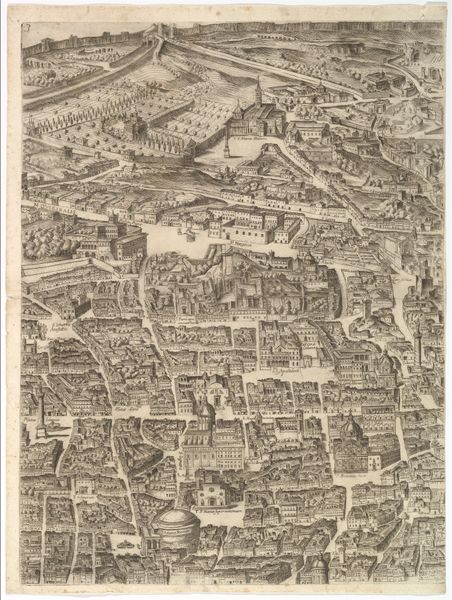
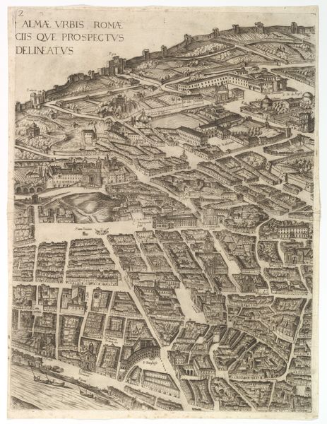
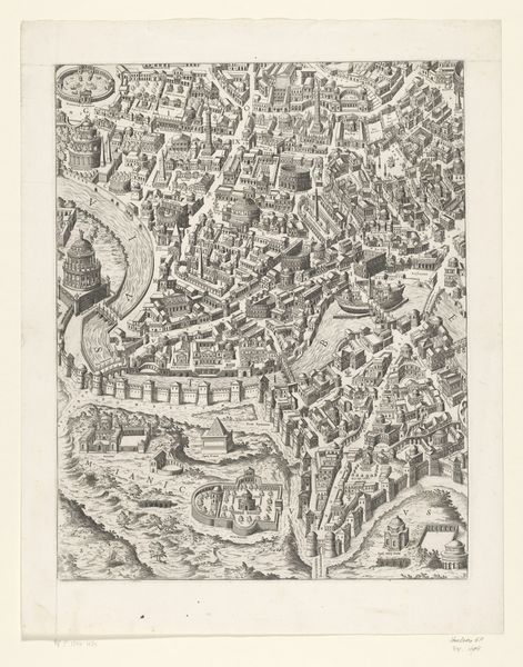
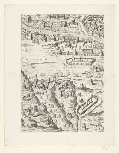
Plan of the City of Rome: sheet 9 with the Piazza Navona, the Campo di Fiore and the Sant' Onofrio 1645
drawing, print, etching
drawing
baroque
etching
geometric
cityscape
italian-renaissance
Dimensions: Sheet: 21 3/4 x 16 5/16 in. (55.3 x 41.5 cm) Plate: 20 15/16 x 15 3/4 in. (53.2 x 40 cm)
Copyright: Public Domain
This is sheet 9 of Antonio Tempesta’s "Plan of the City of Rome," made using engraving techniques. The dense network of lines creates a detailed aerial view, meticulously mapping the urban landscape with its buildings, streets, and the Tiber River. The monochromatic palette emphasizes structure and form, highlighting the contrast between open spaces and built environments. Tempesta’s plan functions as both a visual document and an exercise in spatial representation. The orthogonal projection, combined with subtle perspective, challenges conventional notions of space. This tension between accuracy and abstraction invites a semiotic reading. The engraving presents Rome not merely as a physical location, but as a coded representation of power. Note how the varying line weights and densities articulate the architectural volumes. This technique creates a play of light and shadow across the cityscape. The city is transformed into a complex interplay of signs, where each structure signifies its social and cultural role within the urban fabric.
Comments
No comments
Be the first to comment and join the conversation on the ultimate creative platform.