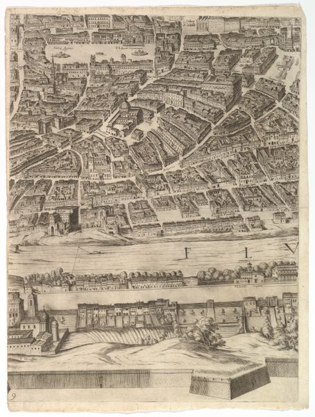
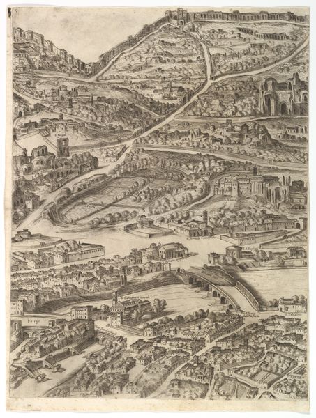
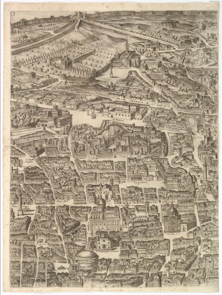
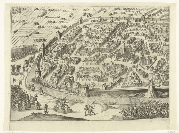
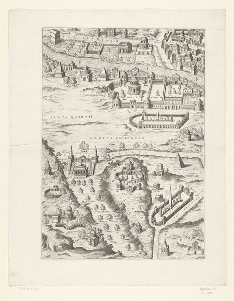
Plan of the City of Rome. Part 11 with the San Pancrazio (left bank) 1645
drawing, print, etching
pen and ink
landscape illustration sketch
drawing
baroque
pen drawing
mechanical pen drawing
pen sketch
etching
pencil sketch
old engraving style
personal sketchbook
pen-ink sketch
pen work
cityscape
Dimensions: Sheet: 21 13/16 x 16 5/16 in. (55.4 x 41.5 cm) Plate: 21 1/4 x 16 in. (53.9 x 40.6 cm)
Copyright: Public Domain
Antonio Tempesta created this section of his "Plan of the City of Rome" as an engraving sometime between 1570 and 1630. This print is not just a map, but also a window into Rome's urban and social structure. Notice how Tempesta meticulously details the city's architecture, from the grand churches to the more modest homes, all within the imposing city walls. The rigid organization of space reflects the strict social hierarchies of the time, dictated by the powerful Roman Catholic Church and the aristocratic families who controlled the city's resources. Mapping and printmaking were strategic tools for asserting power and creating a shared understanding of the city. To truly understand this print, we must consider the political climate of Counter-Reformation Rome, where the Church sought to reassert its authority through art and architecture. By studying period documents, architectural plans, and social histories, we can begin to decode the messages embedded within this seemingly straightforward depiction of the city.
Comments
No comments
Be the first to comment and join the conversation on the ultimate creative platform.