About this artwork
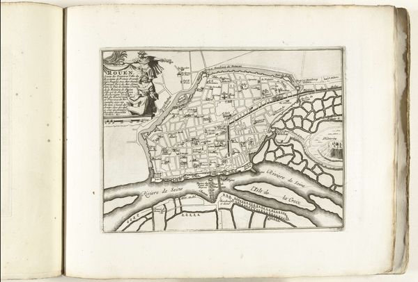
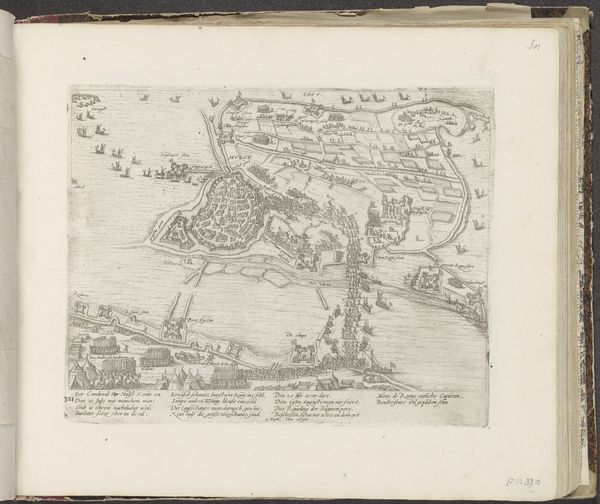
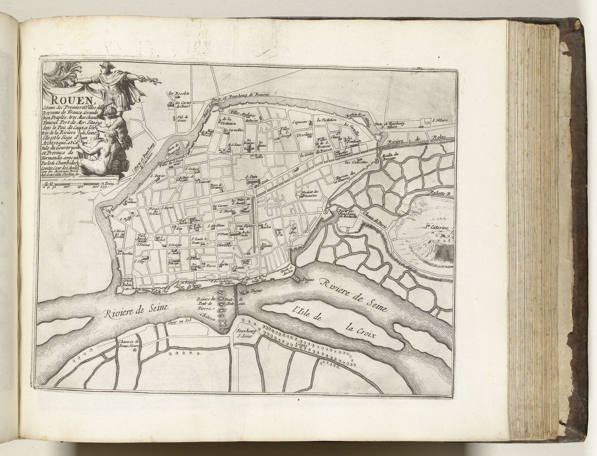
Curator: Welcome. Before us, we have a city plan of Rouen, dating back to circa 1693-1696. It’s rendered with ink on paper, a print of sorts, and currently held here at the Rijksmuseum. Editor: Oh, wow. It's intricate, like a little labyrinth captured on paper. There's a strange peace about it, knowing all those little streets hold stories and lives I’ll never know. Curator: Precisely! Its Baroque stylings offer us insights into urban planning of the period. Look how geometrically rigid the town planning is, how the buildings and land features are clearly defined in their forms. Semiotics of the 17th century. Editor: I see what you mean. Very…organised, even a little suffocating? I almost feel bad for the trees! The Seine dominates, doesn't it? Giving and also dividing the whole map, very powerful. It makes me think about history—how many events these streets and this river have witnessed. War. Plague. Markets. Curator: Yes! This piece does engage with a form of history-painting by immortalizing Rouen as an entity. Note the figures framing the upper-left, gesturing to the city itself; it's not *just* geography; it's the embodiment of Rouen as a historical actor. Editor: Absolutely! You can almost feel the pulse of a bygone era through the details – a world teeming with bustling streets and hidden narratives. Curator: It certainly invites reflection on how we perceive and represent our world, whether then or now. And the artistry of rendering a lived space…it adds a whole other dimension to historical documentation. Editor: Well said. To think all this exists only to represent what’s really there! And with such detail. A reflection upon reflections, if you like. Curator: Precisely! Thank you for contributing. Shall we move on?
Artwork details
- Medium
- drawing, print, paper, ink
- Dimensions
- height 230 mm, width 293 mm
- Location
- Rijksmuseum
- Copyright
- Rijks Museum: Open Domain
Tags
drawing
baroque
paper
ink
geometric
cityscape
history-painting
Comments
Be the first to share your thoughts about this work.
About this artwork
Curator: Welcome. Before us, we have a city plan of Rouen, dating back to circa 1693-1696. It’s rendered with ink on paper, a print of sorts, and currently held here at the Rijksmuseum. Editor: Oh, wow. It's intricate, like a little labyrinth captured on paper. There's a strange peace about it, knowing all those little streets hold stories and lives I’ll never know. Curator: Precisely! Its Baroque stylings offer us insights into urban planning of the period. Look how geometrically rigid the town planning is, how the buildings and land features are clearly defined in their forms. Semiotics of the 17th century. Editor: I see what you mean. Very…organised, even a little suffocating? I almost feel bad for the trees! The Seine dominates, doesn't it? Giving and also dividing the whole map, very powerful. It makes me think about history—how many events these streets and this river have witnessed. War. Plague. Markets. Curator: Yes! This piece does engage with a form of history-painting by immortalizing Rouen as an entity. Note the figures framing the upper-left, gesturing to the city itself; it's not *just* geography; it's the embodiment of Rouen as a historical actor. Editor: Absolutely! You can almost feel the pulse of a bygone era through the details – a world teeming with bustling streets and hidden narratives. Curator: It certainly invites reflection on how we perceive and represent our world, whether then or now. And the artistry of rendering a lived space…it adds a whole other dimension to historical documentation. Editor: Well said. To think all this exists only to represent what’s really there! And with such detail. A reflection upon reflections, if you like. Curator: Precisely! Thank you for contributing. Shall we move on?
Comments
Be the first to share your thoughts about this work.