print, engraving
#
baroque
#
mechanical pen drawing
# print
#
pen sketch
#
old engraving style
#
personal sketchbook
#
sketchwork
#
pen-ink sketch
#
pen work
#
sketchbook drawing
#
history-painting
#
storyboard and sketchbook work
#
sketchbook art
#
engraving
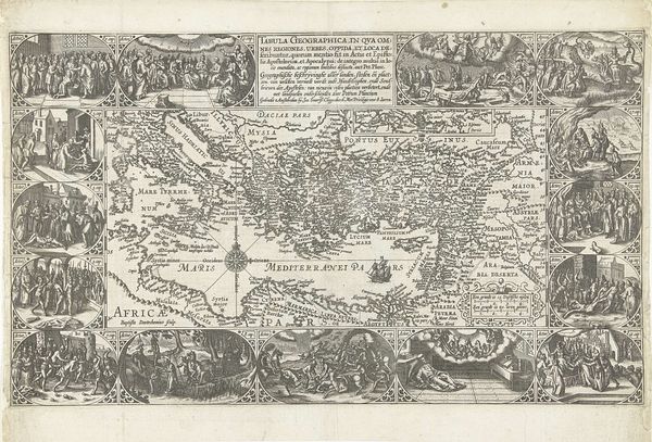
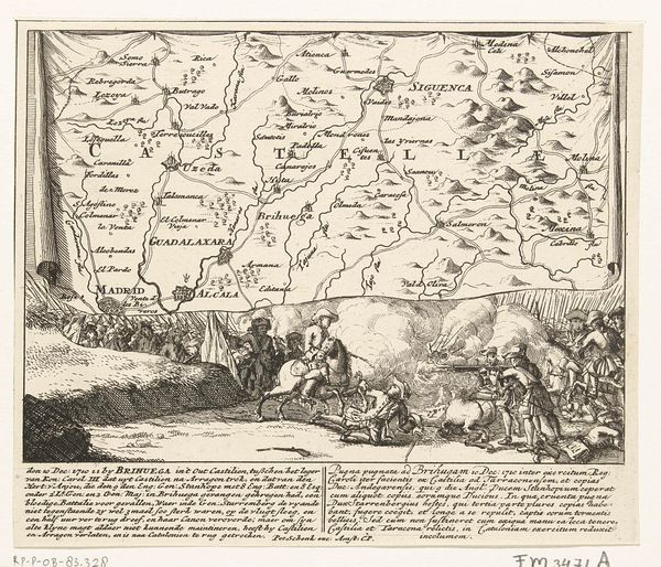
Dimensions: height 231 mm, width 304 mm
Copyright: Rijks Museum: Open Domain
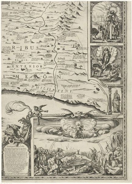
This is a map of northeastern Austria by Cornelis Huyberts, created around the turn of the 18th century. The engraving offers a stark contrast between the detailed geographical rendering above and the dramatic allegorical scene below. Observe the structure: the upper register presents a meticulous landscape, its topographic lines and place names forming a dense, almost abstract pattern. Below, Huyberts shifts to a figurative mode, framing the map's title with classical figures and battle scenes. This juxtaposition isn't merely decorative. It suggests a tension between rational cartography and the chaos of human conflict. The map, with its claim to objective representation, is literally grounded in the theater of war, implying that even the most precise knowledge is implicated in power and violence. Consider, too, the semiotic interplay: the upper map section functions as a denotative sign, aiming to directly represent geographical reality. Conversely, the lower section introduces connotative signs, rich in symbolic meaning. The map challenges us to consider how the very act of mapping is a cultural and political endeavor, one that frames our understanding of territory and conflict.
Comments
No comments
Be the first to comment and join the conversation on the ultimate creative platform.
More like this