About this artwork
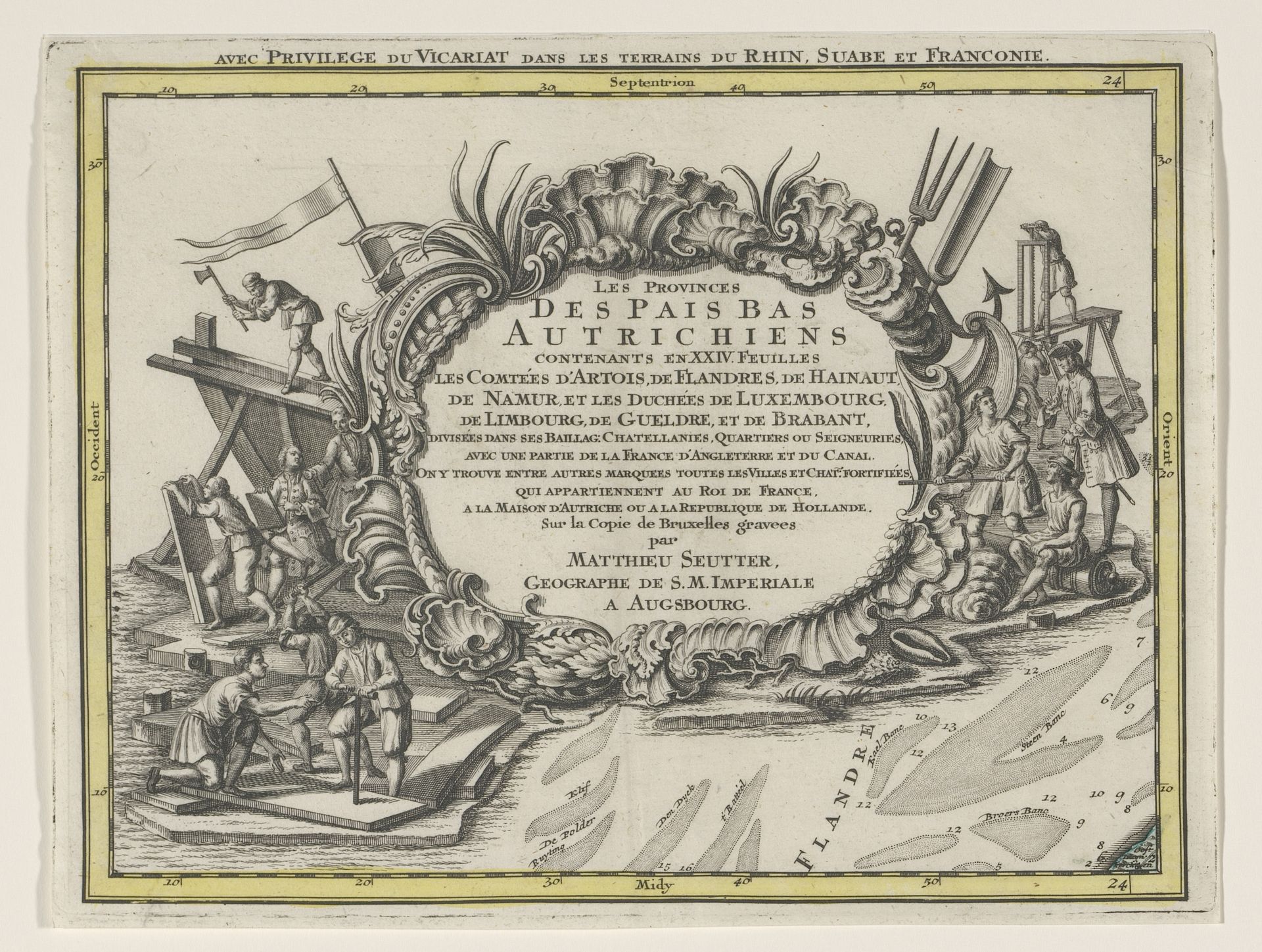
Curator: This is "Deel van een kaart van de Oostenrijkse Nederlanden," a print from sometime between 1737 and 1757 by Tobias Conrad Lotter. The baroque detailing around the central cartouche is what initially grabs me; how about you? Editor: It feels very busy, almost overwhelmingly so! I'm struck by the contrast between the decorative border and what seems like a fairly straightforward map section. It feels unbalanced. What do you see in the composition that I might be missing? Curator: I appreciate your attention to the balance, or lack thereof. Let’s consider the function of these contrasting elements. The baroque cartouche acts as a frame, but one that refuses to be purely decorative. Do you notice how it integrates scenes of labor? Construction and agriculture seem to define it as much as the ornamental flourishes. Editor: Now that you mention it, the contrast between ornamentation and practicality is really interesting! Almost like a commentary on the relationship between the rulers and the ruled? Curator: Perhaps. Or it could also point to the inherent tension between representation and reality within cartography itself. Are we mapping a territory or constructing an idea of it? Notice the stark linearity that define what appears to be "Flanders," a crude simplification perhaps, within the detail offered inside the baroque enclosure. Editor: That's a very different way to approach it! It shows the push and pull between something beautiful and something functional. I never would have seen that tension without you pointing it out. Curator: And I, perhaps, become too easily absorbed in decoding. Your initial sense of unease is equally valuable.
Deel van een kaart van de Oostenrijkse Nederlanden 1737 - 1757
Artwork details
- Medium
- print, engraving
- Dimensions
- height 202 mm, width 264 mm
- Copyright
- Rijks Museum: Open Domain
Tags
baroque
geometric
line
history-painting
northern-renaissance
engraving
Comments
No comments
About this artwork
Curator: This is "Deel van een kaart van de Oostenrijkse Nederlanden," a print from sometime between 1737 and 1757 by Tobias Conrad Lotter. The baroque detailing around the central cartouche is what initially grabs me; how about you? Editor: It feels very busy, almost overwhelmingly so! I'm struck by the contrast between the decorative border and what seems like a fairly straightforward map section. It feels unbalanced. What do you see in the composition that I might be missing? Curator: I appreciate your attention to the balance, or lack thereof. Let’s consider the function of these contrasting elements. The baroque cartouche acts as a frame, but one that refuses to be purely decorative. Do you notice how it integrates scenes of labor? Construction and agriculture seem to define it as much as the ornamental flourishes. Editor: Now that you mention it, the contrast between ornamentation and practicality is really interesting! Almost like a commentary on the relationship between the rulers and the ruled? Curator: Perhaps. Or it could also point to the inherent tension between representation and reality within cartography itself. Are we mapping a territory or constructing an idea of it? Notice the stark linearity that define what appears to be "Flanders," a crude simplification perhaps, within the detail offered inside the baroque enclosure. Editor: That's a very different way to approach it! It shows the push and pull between something beautiful and something functional. I never would have seen that tension without you pointing it out. Curator: And I, perhaps, become too easily absorbed in decoding. Your initial sense of unease is equally valuable.
Comments
No comments