print, etching, engraving
#
pen and ink
#
dutch-golden-age
# print
#
etching
#
landscape
#
geometric
#
cityscape
#
engraving
Dimensions: height 176 mm, width 267 mm
Copyright: Rijks Museum: Open Domain
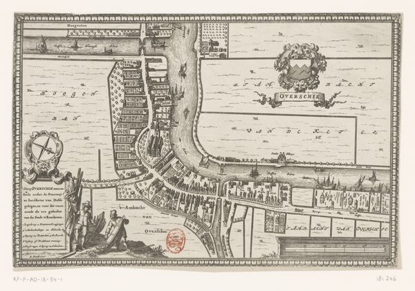
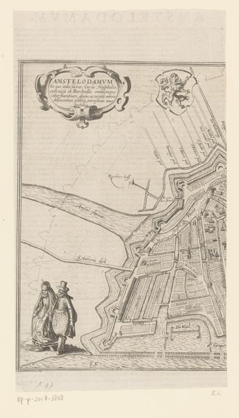
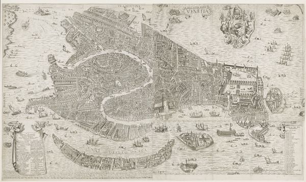
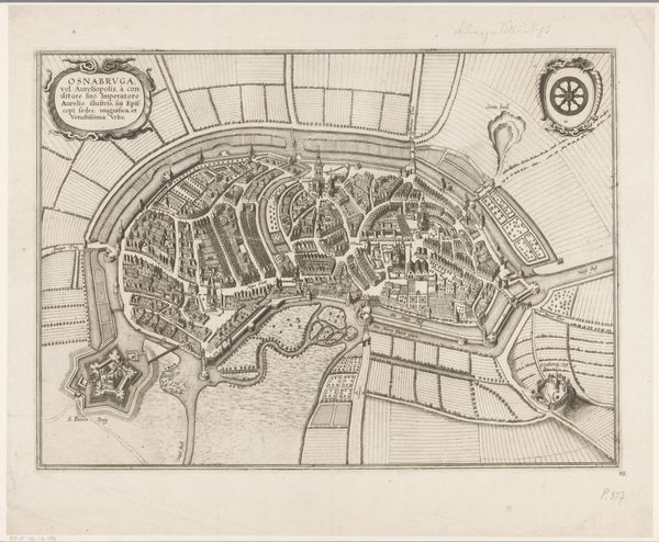
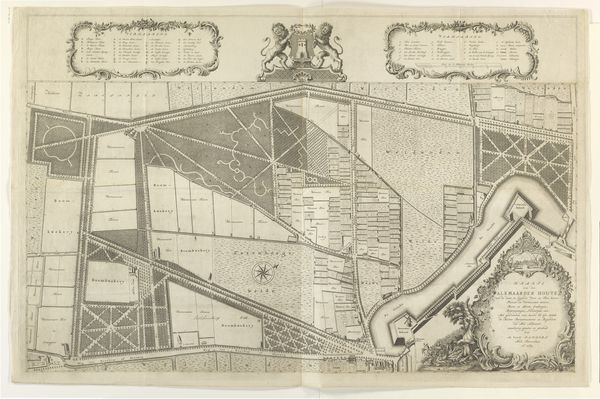
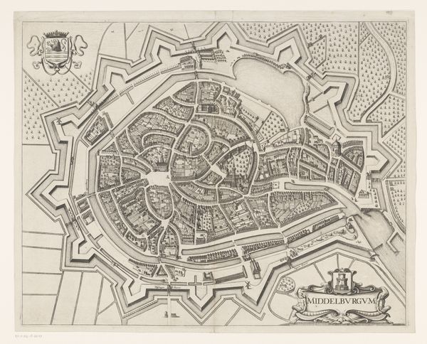
Curator: We're now looking at a "Plattegrond van Delfshaven," or "Map of Delfshaven," created between 1678 and 1703. The artist, Johannes de Ram, used etching, engraving, and pen and ink to depict this cityscape. Editor: My initial reaction is the incredible detail! The linework is so fine, creating a remarkably clear rendering of this port city. It's monochrome, of course, giving it a somewhat stark but highly ordered appearance. Curator: Absolutely. Delfshaven, as part of Rotterdam, was a vital port during the Dutch Golden Age. Maps like these were essential for trade and navigation. It underscores the power of cartography and its intersection with economic and political ambition. They visually represent not just space, but control. Editor: And look how the geometric organization creates different shapes. The buildings are rectangular, the canals run in precise lines, yet the harbour has a beautiful curvilinear quality as it follows the natural bend. I see geometric structure meeting organic freedom. Curator: That deliberate contrast likely highlights human order versus the natural world, a theme recurrent in landscape art of the period. Think about what this map signifies – the taming and utilization of nature for Dutch mercantile success. These clean lines were powerful statements of Dutch achievement. Editor: Also, the contrast in texture interests me. Note the dense cross-hatching which indicate buildings and landscape versus more open area. Different graphic styles are used to separate landscape and water with clear boundaries. Curator: Beyond aesthetic considerations, this map functioned as propaganda for Dutch progress, both domestic and abroad, shaping public perception. Note how much text has been included; this would likely convey the importance of the infrastructure and opportunities it represents. Editor: Ultimately, a superb exercise in organizing information using graphic tools; beautiful in its complexity. Curator: Indeed. When we examine the intersection of cartography, commerce, and civic identity, a detailed piece such as this reveals an enormous amount about its time.
Comments
No comments
Be the first to comment and join the conversation on the ultimate creative platform.
More like this