drawing, print, paper, ink
#
drawing
#
dutch-golden-age
# print
#
landscape
#
perspective
#
paper
#
ink
#
geometric
#
cityscape
#
genre-painting
#
history-painting
Dimensions: height 287 mm, width 365 mm
Copyright: Rijks Museum: Open Domain
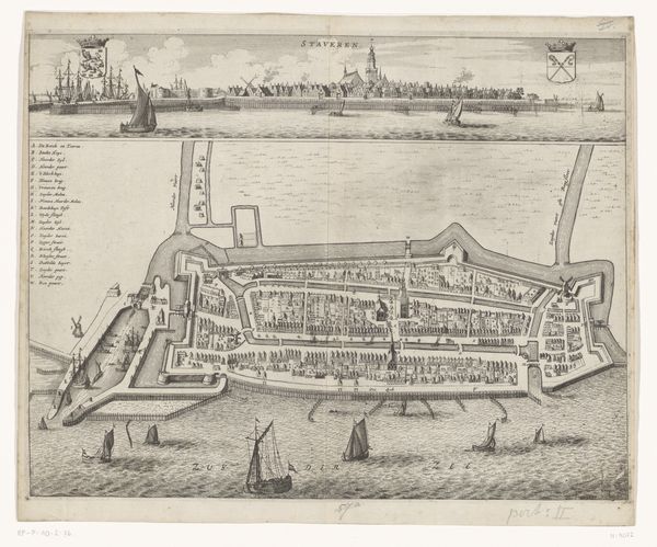
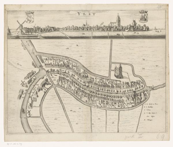
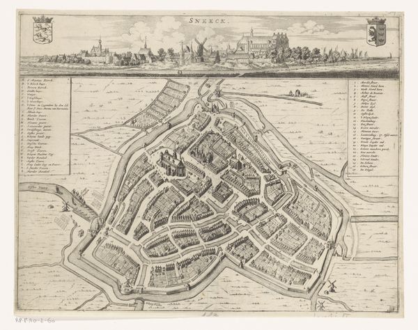
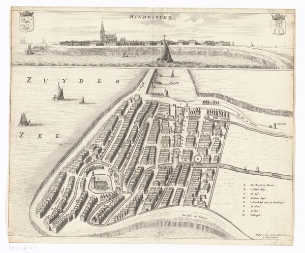
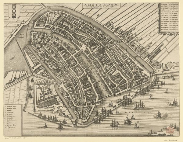
Curator: Here we have a fascinating print from 1664, titled "Plattegrond van Workum met stadsgezicht," attributed to Jacob van Meurs. It's a detailed town plan of Workum, combining both a bird's-eye view and a map. Editor: Immediately, I'm struck by the sheer density of detail. It’s a complex web of lines, shapes, and textures. The monochromatic palette amplifies this intricacy, focusing the eye on the forms themselves. Curator: The plan provides a unique lens through which to view 17th-century Dutch society. Notice how the artist meticulously represents the layout of the town, which reflects a hierarchical social structure. Land ownership, prominent religious buildings, and defensive walls—all symbolic of power and order. Editor: Yes, the geometrical precision is notable. The artist is employing orthogonal projections to render space in a clear, almost scientific way. The map uses this to structure reality, transforming space into symbolic information that anyone could interpret. Curator: Exactly. Moreover, considering the Dutch Golden Age, the artwork functions almost as a subtle statement of civic pride and economic power, a common theme among Dutch cityscapes and genre paintings of the era. Mapping and art were used for building and promoting a Dutch sense of place. Editor: The symbolism, though, is carefully controlled by this rigorous linear order. The perspective view along the top flattens into geometric space. The result offers an intriguing tension between naturalistic depiction and symbolic encoding. Curator: Perhaps the artist was subtly commenting on the relationship between representation, power, and the lived experience of the citizens of Workum. Editor: An intriguing question to pose indeed. Examining Van Meurs' handling of line, we uncover a complex dialogue about structure and representation. It allows us to consider ways in which linear perspective produces meaning, literally structuring what is seen, as well as unseen in Golden Age painting. Curator: In that respect, this "Plattegrond van Workum" offers insights not only into a specific place and time, but also into our understanding of visual representation itself.
Comments
No comments
Be the first to comment and join the conversation on the ultimate creative platform.
More like this