print, engraving
#
dutch-golden-age
# print
#
geometric
#
engraving
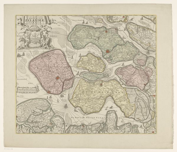
Dimensions: height 465 mm, width 543 mm
Copyright: Rijks Museum: Open Domain
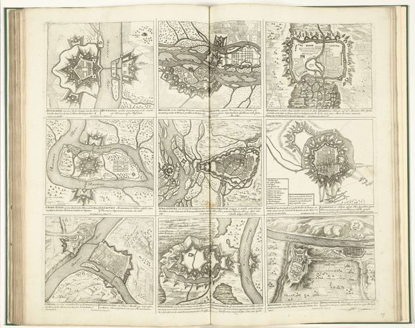
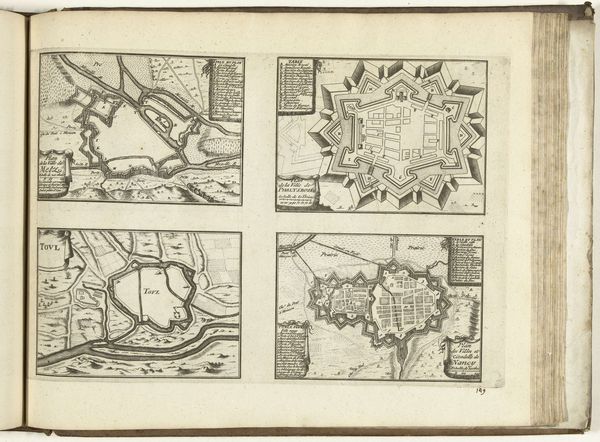
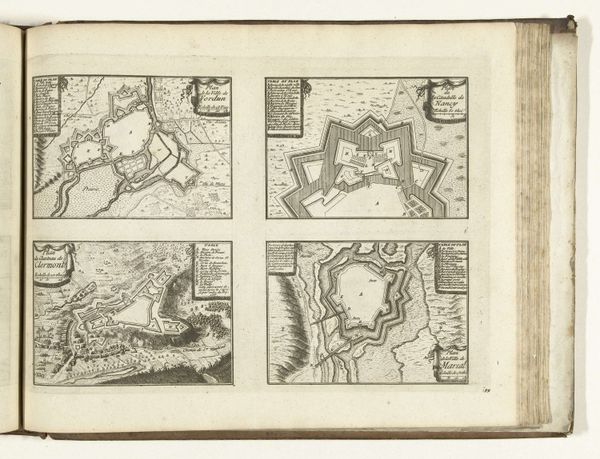
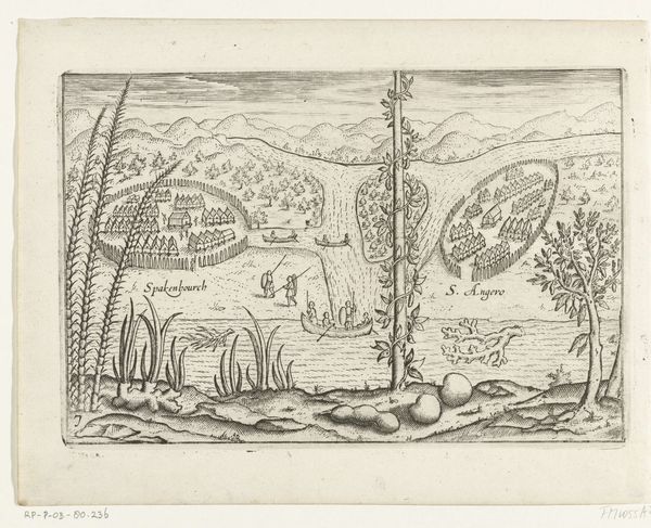
Editor: Here we have an engraving entitled "Kaart van Zeeland," dating from around 1718 to 1750, made by an anonymous artist. It’s currently housed in the Rijksmuseum. What strikes me immediately is the detailed depiction of the landscape. How do you interpret this work as a historian? Curator: Well, first we have to consider the historical context of cartography. Maps weren’t simply objective representations of space, especially during the Dutch Golden Age. They were also instruments of power, knowledge, and national identity. What does a map of Zeeland, a province comprised of islands, suggest to you about Dutch identity at the time? Editor: Hmm, perhaps that Zeeland's maritime power and geographical positioning were key to their identity. The elaborate figures at the upper right suggest a level of civic pride, too? Curator: Exactly! Notice the Neptune figure and the personification of Zeeland. These maps celebrated Dutch control over the seas, showcasing the region's strategic importance for trade and defense. Think about who would have commissioned and displayed a map like this. What kind of message were they trying to convey? Editor: I imagine merchants, ship owners, or government officials would be interested. It projects a very powerful image of a confident, seafaring nation. So it's less about pure geography, more about… asserting dominance? Curator: Precisely. Maps, even something that appears to be just for navigation, can serve a crucial political and social function. They reinforced Dutch authority, both domestically and internationally, especially during a period of intense competition with other European powers. What do you think you will take away from viewing this print now? Editor: I guess I’ll be looking at maps with a more critical eye. They aren't neutral; they actively promote a certain worldview. Curator: I completely agree; that’s how museums give voices to historical interpretations.
Comments
No comments
Be the first to comment and join the conversation on the ultimate creative platform.
More like this