print, engraving
#
dutch-golden-age
# print
#
landscape
#
geometric
#
engraving
Dimensions: height 150 mm, width 197 mm
Copyright: Rijks Museum: Open Domain
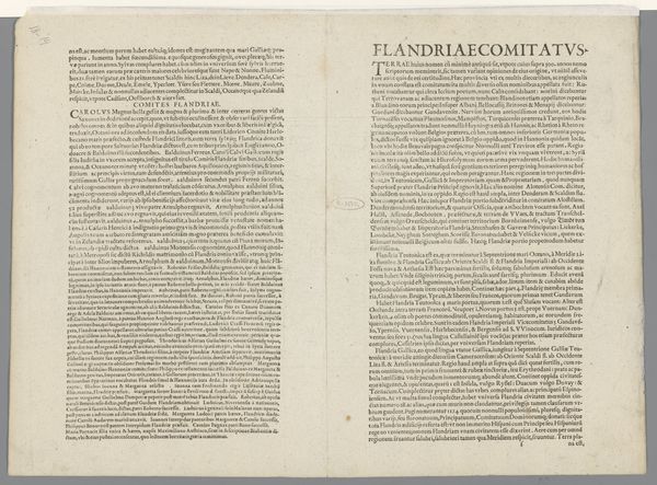
This map of the county of Holland, created around 1570-1590 by Frans Hogenberg, presents us with a fascinating display of text as image. Latin words fill the page, each a symbol of a specific place, hinting at histories, economies, and cultural identities. The use of text as a dominant visual element harkens back to medieval illuminated manuscripts, where words were not just carriers of meaning but also objects of aesthetic contemplation. Note how the arrangement and density of the text create a visual texture, almost like a woven tapestry. This echoes the ancient practice of cartography, where maps were as much about conveying objective information as they were about projecting power and cultural understanding. The act of naming and listing, seen here, resonates with humanity's perennial urge to order and control the world through language. The text becomes a collective memory, encapsulating the knowledge and aspirations of a culture. This map speaks to the enduring human need to chart our place in the world, both physically and symbolically, a need that continues to drive us today.
Comments
No comments
Be the first to comment and join the conversation on the ultimate creative platform.
More like this