graphic-art, print, engraving
#
graphic-art
# print
#
early-renaissance
#
engraving
Dimensions: height 174 mm, width 269 mm
Copyright: Rijks Museum: Open Domain
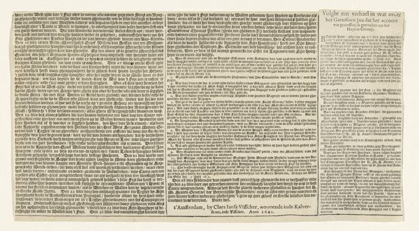
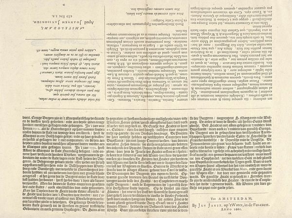
Curator: Today, we're examining "Kaart van het beleg van Huis te Gennep (tekstblad), 1641," an engraving from 1641 now held at the Rijksmuseum. Editor: It strikes me as quite stark—the contrast is extreme. Almost architectural in its severe lines, and strangely calming for a document about a siege. Curator: Indeed. Created by Claes Jansz. Visscher, the piece depicts a map of the siege of Gennep, chronicling the Prince of Orange’s efforts during the Eighty Years' War. The starkness you observe, that's partially attributable to the engraving medium itself, lends the image an assertive, almost declarative feel. Editor: The Prince of Orange! So, what looks like abstract geometry to the modern eye was likely brimming with symbolic weight for contemporary viewers. Gennep, this key strategic location; the positioning of armies… Each detail becomes a carefully considered signifier in a prolonged conflict, almost totemic. Curator: Precisely. Notice how Visscher uses the very density of line to convey areas of fortification and activity, offering a sense of depth. It's not merely a record but an interpretation, almost a dramatization, of spatial relations and military actions. The artist emphasizes function. Editor: Yes, function, but also the theater of power. The map elevates the siege to a symbolic level; it becomes a representation of strategic intent. It speaks of national identity and resistance. The image is dominated by imposing blocks of descriptive text. They function less as labels, more as epic pronouncements. Curator: A fascinating point. Ultimately, it brings our contemporary viewpoint face-to-face with seventeenth-century imperatives to understand the image. Editor: Yes, understanding Visscher’s map on its own terms illuminates the degree to which visual symbols shaped and reflected a period of great cultural and political conflict.
Comments
No comments
Be the first to comment and join the conversation on the ultimate creative platform.
More like this