print, engraving
#
baroque
# print
#
old engraving style
#
history-painting
#
engraving
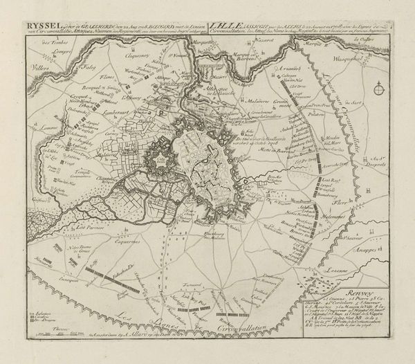
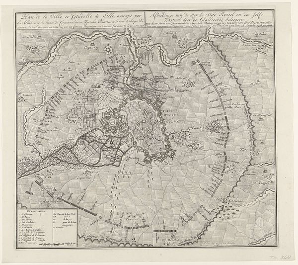
Dimensions: height 599 mm, width 422 mm
Copyright: Rijks Museum: Open Domain
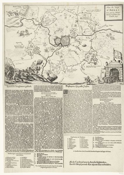
Curator: Editor: This print, "Plan van het beleg van Lille, 1708" from 1708 by an Anonymous artist, presents a baroque engraving detailing the siege of Lille. I am struck by how meticulously the siege is mapped out, almost like a carefully planned ritual. It evokes a sense of calculated power. What catches your eye when you look at this? Curator: I notice how the city is contained within this circular enclosure, this "circumvallation." The circle itself is a powerful symbol – of totality, of protection, but here, also of imprisonment. The image feels less like a celebration of victory, and more like an acknowledgment of containment, an image where one side waits for the other to exhaust. How does the artist invite us to reflect upon our place in its world? Editor: I see your point. The siege lines really emphasize that idea of containment and a forced ending, rather than victory. It is compelling how such seemingly neutral, descriptive depictions of military actions can also be imbued with profound symbols, almost allegorical in their meaning. In many ways, aren’t war maps always propaganda of some kind, to instill trust in their decisions. The print presents it more strategically and less glorifying the conflict itself. I wonder if the map invites different responses, perhaps from someone living outside, or inside the line? Curator: Exactly. Consider who this print was for, and what purpose it served. The sheer density of text below, cataloging the regiments involved, speaks to the importance of documentation, of meticulously recording history, but with whose pen, of course? It might signal administrative intentions, far from military passions, and thus open it up to diverse, subjective readings. How has our understanding of such imagery evolved since 1708, do you think? Editor: Well, I'm starting to look at these depictions of war differently, focusing on what the symbols mean instead of only looking at face value. It brings up a lot more questions than I had initially considered! Curator: Precisely, by examining the symbolic layers within seemingly straightforward historical documents, we reveal their underlying narratives and their power to shape collective memory. A battlefield of different meanings starts opening in front of us.
Comments
No comments
Be the first to comment and join the conversation on the ultimate creative platform.
More like this