drawing, print, paper, engraving
#
drawing
#
aged paper
#
dutch-golden-age
#
parchment
# print
#
old engraving style
#
paper
#
geometric
#
line
#
pen work
#
engraving
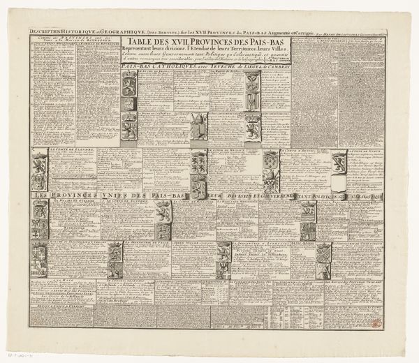
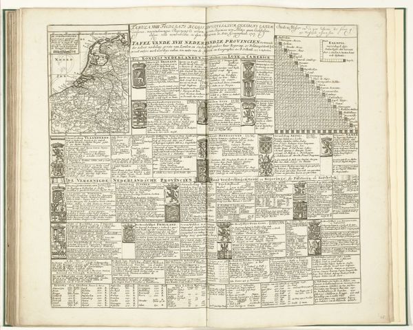
Dimensions: height 485 mm, width 577 mm
Copyright: Rijks Museum: Open Domain
This is "Kaart van de Zeventien Provinciën met uitleg," made around 1700 by Caspar Specht as an engraved map. The most striking element here is the heraldic symbols. Each province proudly displays its coat of arms, a visual shorthand representing its unique history, power, and identity. These emblems are not mere decorations; they are potent symbols of sovereignty and heritage. Consider the lion rampant, a motif that recurs in several of these coats of arms. This heraldic beast, a symbol of courage, nobility, and royalty, echoes through history, appearing in emblems from ancient Mesopotamia to medieval Europe. Its persistent presence speaks to the human desire to assert power and lineage. The symbols chosen for these arms would resonate deeply within the collective memory of the local population. They tap into deeply held emotions, forging a sense of belonging and shared identity. Their continued reappearance throughout history signifies the persistence of cultural memory, adapting to new contexts.
Comments
No comments
Be the first to comment and join the conversation on the ultimate creative platform.
More like this