drawing, print, ink, engraving
#
drawing
# print
#
landscape
#
ink
#
history-painting
#
engraving
Dimensions: height 240 mm, width 360 mm
Copyright: Rijks Museum: Open Domain
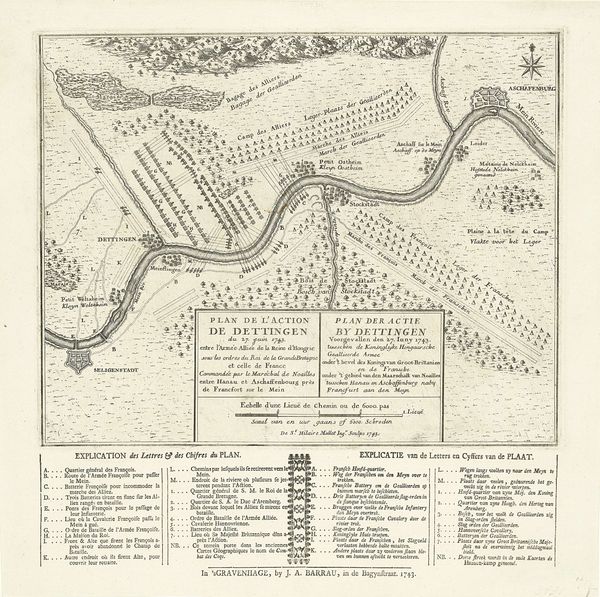
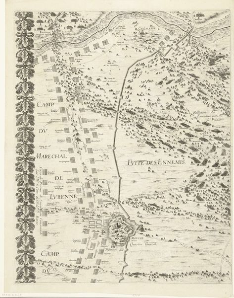
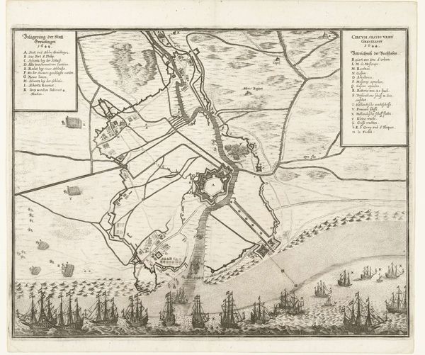
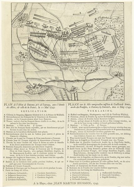
Andreas Reinhard II created this ‘Plan van de slag bij Dettingen’ in 1743, using ink on paper. The means of its making – engraving – are central to its purpose. Engraving allowed for the meticulous rendering of spatial relations, converting a three-dimensional battlefield into a two-dimensional schematic. The process involves considerable physical labor, cutting into the copperplate to create lines that hold ink, before being transferred onto paper. This precise method also speaks to the Enlightenment era’s emphasis on reason and order. The crisp lines and meticulous detail reflect a desire to capture and convey information with accuracy and clarity. Beyond its informational value, this print also subtly reflects the social context of its creation. Such prints were tools of power and control, translating military events into digestible formats for rulers and elites. We are reminded that even seemingly objective representations of historical events are shaped by the materials, techniques, and social forces of their time.
Comments
No comments
Be the first to comment and join the conversation on the ultimate creative platform.
More like this