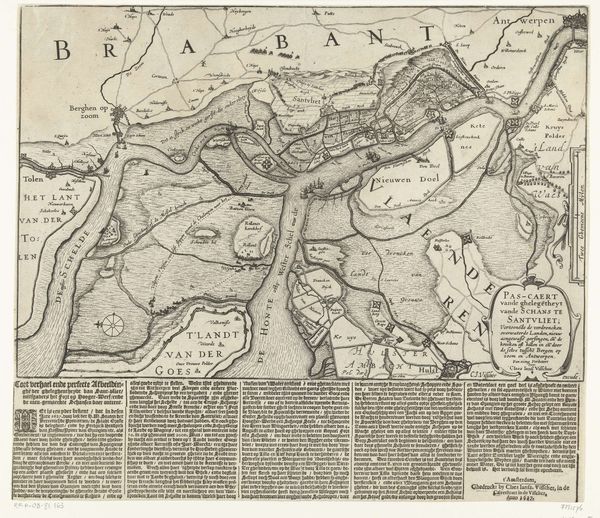
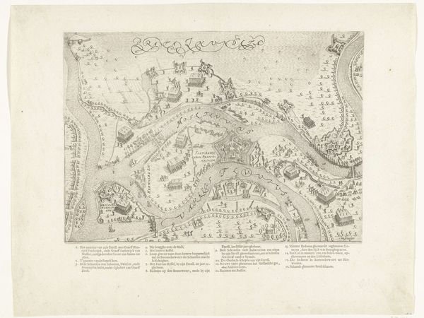
Kaart met de bouw van de Spaanse schans bij Zandvliet, 1627 1627
0:00
0:00
claesjanszvisscher
Rijksmuseum
drawing, print, paper, ink, engraving
#
drawing
#
dutch-golden-age
# print
#
paper
#
ink
#
cityscape
#
engraving
Dimensions: height 364 mm, width 430 mm
Copyright: Rijks Museum: Open Domain
Claes Jansz. Visscher created this detailed map of the Spanish fortification near Zandvliet in 1627 using etching. The stark contrast between the black lines and the off-white paper creates a captivating visual experience. The lines weave a complex web, delineating land, water, and the precise architecture of the schans. Observe how Visscher employs lines of varying thicknesses to differentiate elements. Thicker lines boldly define the borders of landmasses, whereas finer lines intricately sketch the inner details of the fortress. The structural integrity of the fortification is meticulously rendered with acute angles that project an aura of military precision. This cartographic representation serves not only as a geographical document, but also as a narrative of power and control. The systematic ordering of space reflects the prevailing cultural desire to impose order on the natural world. The map functions as a coded representation, each symbol carrying strategic meaning within the broader socio-political landscape of its time.
Comments
No comments
Be the first to comment and join the conversation on the ultimate creative platform.
More like this