lithograph, print
#
lithograph
# print
#
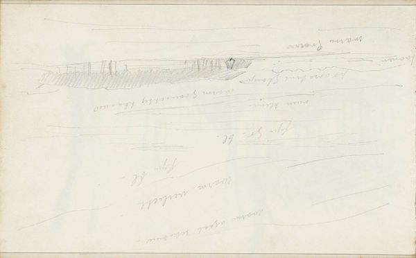
landscape
#
geometric
#
modernism
Dimensions: height 390 mm, width 530 mm
Copyright: Rijks Museum: Open Domain
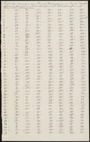
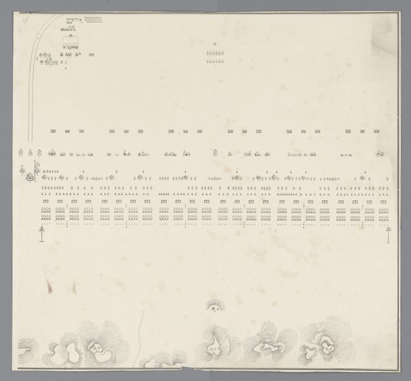
Desiré Heyse made this height map of the Dutch East Indies archipelago from an engraving, but the date is unknown. It presents a series of cross-sectional diagrams that represent the altitude of various islands. In the 19th century, cartography was not just a scientific endeavor, but also a political tool. As the Dutch sought to consolidate their colonial power in the East Indies, accurate geographical information became essential for resource extraction and military control. This map then, can be understood as a visual assertion of Dutch knowledge and authority over the archipelago. Its precision and detail imply a comprehensive understanding of the region, reinforcing the colonizer's sense of mastery. To fully understand the map's significance, one can turn to sources such as colonial archives, travelogues, and scientific reports from the period. These resources reveal the complex interplay between scientific inquiry, imperial ambition, and the lived experiences of both colonizers and colonized populations.
Comments
No comments
Be the first to comment and join the conversation on the ultimate creative platform.
More like this