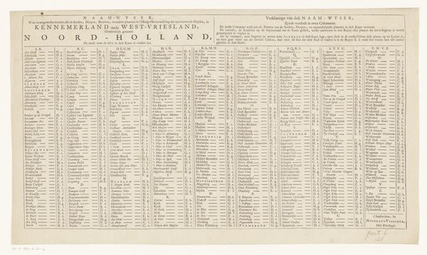
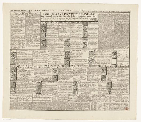
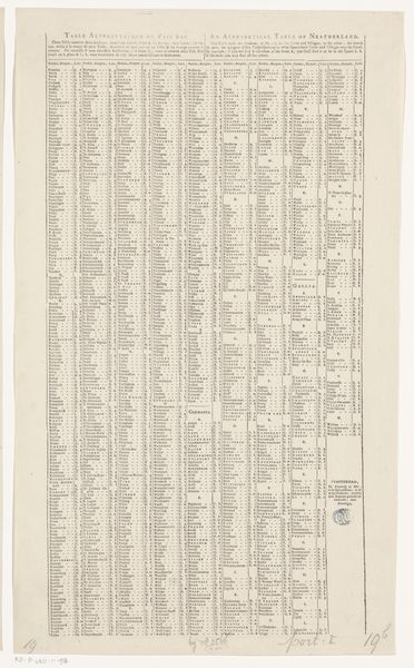
Plaatsregister van alle dorpen en steden te vinden op de bijhorende kaart after 1682
0:00
0:00
nicolaesiivisscher
Rijksmuseum
graphic-art, print, engraving
#
graphic-art
# print
#
engraving
Dimensions: height 465 mm, width 550 mm
Copyright: Rijks Museum: Open Domain
Nicolaes Visscher II created this index of places in the Netherlands around the turn of the 18th century, using etching on paper. The etcher would have coated a copper plate with wax, then drawn through it with a fine needle to expose the metal. The plate was then immersed in acid, which bit into the exposed lines. This created a matrix to hold ink, which could then be transferred to paper through a printing press. The relatively low cost of printmaking meant that information could be disseminated widely, contributing to economic and political life. Look closely, and you’ll see that the even lines of text, while seemingly simple, required skilled labor and specialized tools. Each impression is a testament to the mechanics of production that drove the Dutch Golden Age. It’s a potent reminder that even the most unassuming objects are products of complex social and economic forces, and blurred distinctions between fine art and craft.
Comments
No comments
Be the first to comment and join the conversation on the ultimate creative platform.
More like this