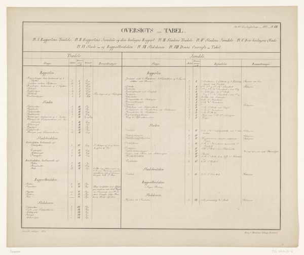
Gedenkstuk. Behoorende bij de Kaart van datgedeelte der Provincie Overijssel, waar de Overstrooming van den 4 en 5 Februarij 1825 de meeste verwoestingen heeft aangebragt (...) 1825
print, etching
etching
landscape
etching
romanticism
realism
Dimensions: height 985 mm, width 642 mm
Copyright: Rijks Museum: Open Domain
This detailed commemorative piece by Abraham Lion Zeelander records the devastating Overijssel floods of February 1825. Above the columns of data, notice the vignette of a family amidst the wreckage. The broken tree, the distressed figures—these are potent symbols of loss and resilience. The image recalls similar motifs found across different cultures, such as in the art of the Great Lisbon Earthquake in 1755. Disasters have long been represented with broken trees and people trying to survive, reflecting a deep, universal anxiety about nature's destructive force. Consider the emotional impact: the shared, primal fear of being overwhelmed. This imagery taps into a collective memory. The family huddled together speaks to our subconscious need for protection. It's a scene that echoes through time. Such motifs are not simply repeated, they’re resurrected—each instance a testament to the enduring power of human suffering and survival.
Comments
No comments
Be the first to comment and join the conversation on the ultimate creative platform.