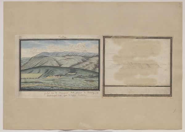
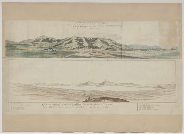
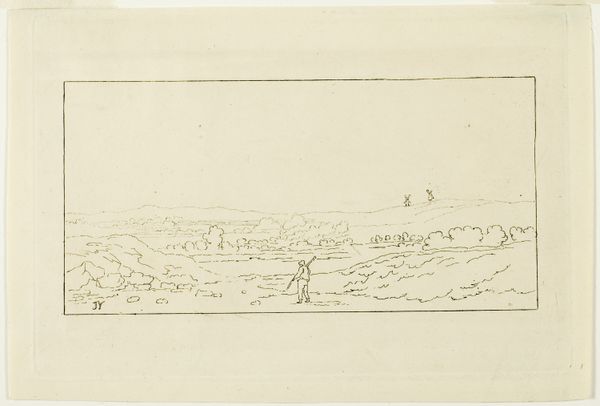
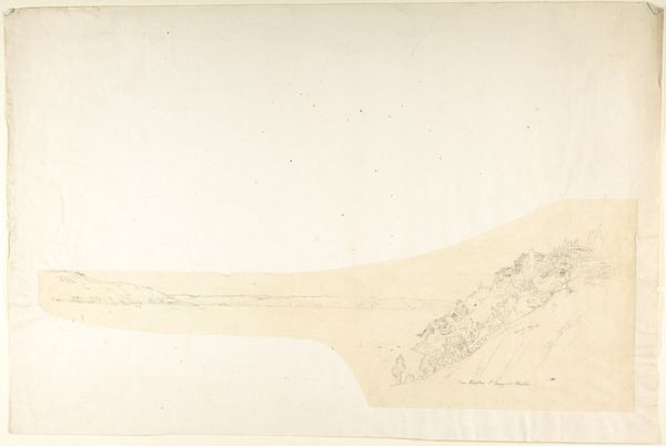
The confluence of the Caledon and Orange Rivers, seen from the south-west Possibly 1777
0:00
0:00
plein-air, watercolor
#
water colours
#
plein-air
#
landscape
#
watercolor
#
coloured pencil
#
watercolor
Dimensions: height 370 mm, width 670 mm
Copyright: Rijks Museum: Open Domain
Curator: Here we have “The confluence of the Caledon and Orange Rivers, seen from the south-west,” likely created around 1777 by Robert Jacob Gordon. He worked primarily en plein-air, using watercolors and colored pencils in this instance. Editor: My initial impression is one of serenity, but also of stark observation. The delicate washes of watercolor give a dreamlike quality, yet the composition feels meticulously mapped out. Curator: It's fascinating how Gordon combines scientific documentation with artistic expression, isn't it? Look at how he meticulously depicts the terrain. His role within the Dutch East India Company profoundly shaped his artistic process and subject matter. This wasn't just art for art's sake, it was about resource extraction and geographical knowledge accumulation for colonial purposes. Editor: Precisely. Consider the formal arrangement—the confluence of the rivers visually dominates. The contrast of the earthy tones in the foreground with the paler blues of the sky emphasizes the geographic layout, almost as if presenting an argument through visual design. Note also the almost grid-like pattern subtly underlying the washes; it’s not purely representational. Curator: Indeed. The choice of watercolor itself speaks to practicality. Easily transportable, quick to dry – perfect for field work and sketching observations during expeditions. How do you see the impact of its materiality influencing our reading? Editor: The fluidity of watercolor, ironically, imposes a soft filter onto what could otherwise be a purely topographic exercise. I agree it aided in practicality but also allows for a less fixed reading—less about concrete reality and more about interpretation through rendering. The materiality softens its documentary intentions. Curator: So even through what may have started as a tool of colonial cartography, we see opportunities to reconsider the narrative through analyzing the production context itself. These depictions impacted both land management strategies, and perceptions that ultimately shaped historical and economic landscapes. Editor: Agreed, a fascinating dialogue emerges between intention and interpretation based on the formal properties of how we encounter the artwork.
Comments
No comments
Be the first to comment and join the conversation on the ultimate creative platform.
More like this