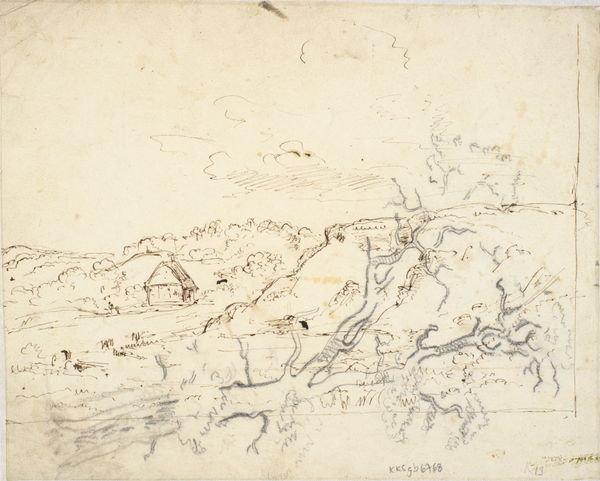
drawing, pencil
#
drawing
#
neoclassicism
#
landscape
#
pencil
Dimensions: height 1135 mm, width 655 mm
Copyright: Rijks Museum: Open Domain
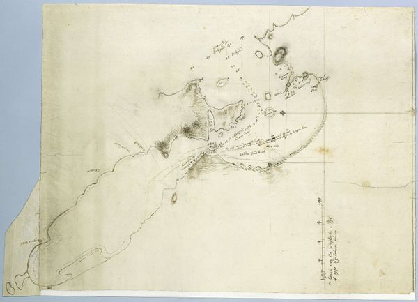
Robert Jacob Gordon rendered this map of Table Bay and Robben Island as part of his work for the Dutch East India Company, likely in the late 18th century. As a military commander and explorer, Gordon’s maps served practical functions, providing crucial information for navigation and defense. But they also served as instruments of colonial power. The detailed rendering of the landscape, the careful notation of depths and bearings – these were all ways of claiming and controlling territory. Consider how the blank spaces on the map might stand in for the unknown, the uncharted, and the unconquered. Or, reflect on Robben Island, a site of imprisonment and suffering, rendered here as a mere object of geographical interest. By studying such images in the context of the Dutch East India Company’s activities, and by comparing them with other historical records, we can better understand the complex social and political forces that shaped this part of the world.
Comments
No comments
Be the first to comment and join the conversation on the ultimate creative platform.
More like this