About this artwork
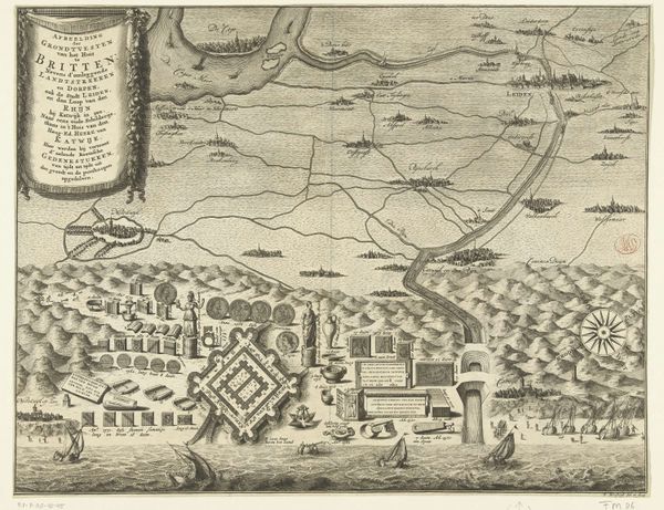
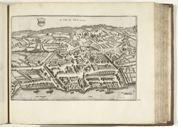
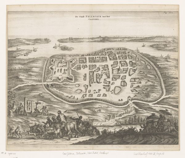
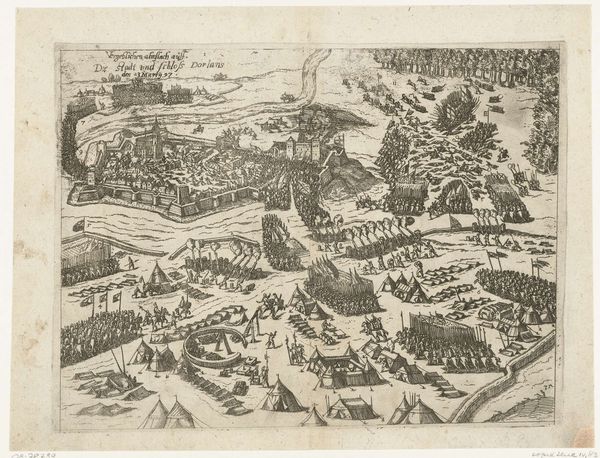
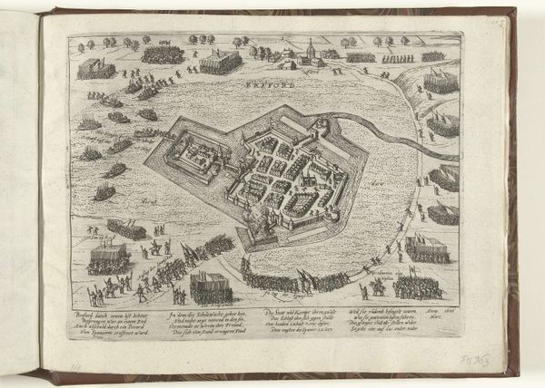
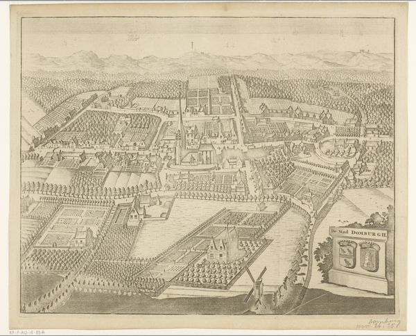
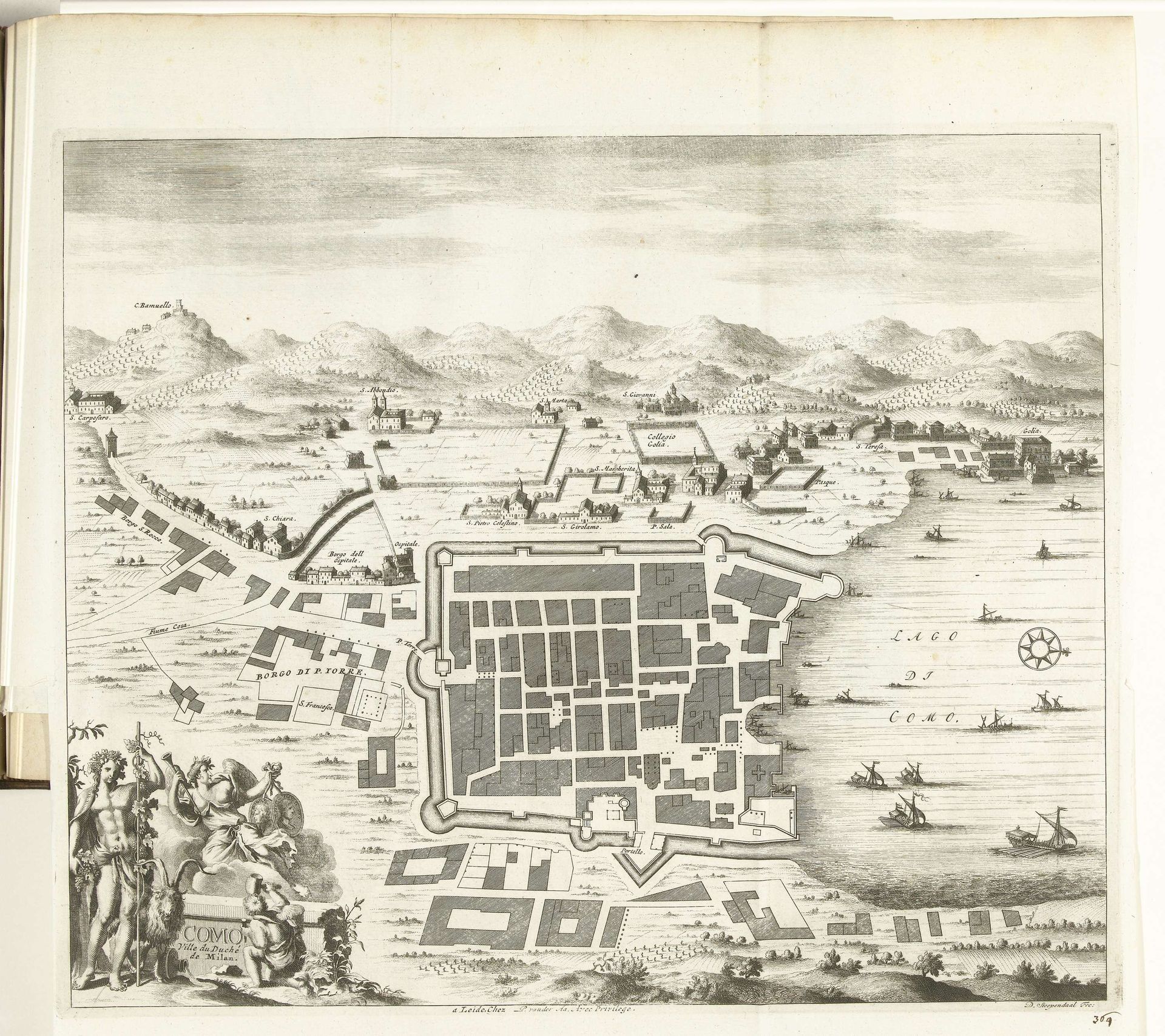
Curator: Here we have a plan of Como, meticulously rendered in 1726 by Daniël Stopendaal. It's an etching and engraving, a printed map showing the city's layout. Editor: It has this strange elegance about it, like peering down at a sleeping giant. Everything's so ordered, yet the tiny ships on the lake inject a sense of the epic, wouldn’t you agree? Curator: Absolutely. And consider the materials. The ink, the paper, the metal plates used for printing; all testify to the industry of 18th-century printmaking, churning out images for consumption by a growing urban audience. Think of the artisan workshops! Editor: I’m drawn to the way the artist plays with perspective. The bird's-eye view gives a sense of power, like you're master of all you survey. The clouds and tiny mountains—they add this dreamy, faraway feeling to a document I suppose that had utilitarian aims. It's quite whimsical for a city map, almost a declaration of love, no? Curator: The city's form as product! It shows us a carefully organized system, with class divisions encoded into the architectural plans, from military structures to religious complexes and industrial ones! Think of the labor required to produce those buildings and this drawing. Editor: When I stare at that intricate linework, all those crosshatched buildings huddled inside their fortifications, I want to invent stories about what occurred within them: intrigues, whispers, betrayals. The rigid structure invites speculation, paradoxically. Curator: Well, it’s designed to shape activity in a functional way! The consumption of this plan fed the imaginary! In the end, Stopendaal shows how this imaginary takes material form and has social context in urban planning. Editor: Indeed, perhaps every map hides a multitude of invisible cities waiting to be discovered. I won't lie; this little cartographical daydream made my day a lot richer. Curator: And it serves as a potent reminder of the layered realities underpinning all urban experience. Every aspect of daily life.
Artwork details
- Medium
- drawing, print, etching, engraving
- Dimensions
- height 347 mm, width 415 mm
- Location
- Rijksmuseum
- Copyright
- Rijks Museum: Open Domain
Tags
Comments
Share your thoughts
About this artwork
Curator: Here we have a plan of Como, meticulously rendered in 1726 by Daniël Stopendaal. It's an etching and engraving, a printed map showing the city's layout. Editor: It has this strange elegance about it, like peering down at a sleeping giant. Everything's so ordered, yet the tiny ships on the lake inject a sense of the epic, wouldn’t you agree? Curator: Absolutely. And consider the materials. The ink, the paper, the metal plates used for printing; all testify to the industry of 18th-century printmaking, churning out images for consumption by a growing urban audience. Think of the artisan workshops! Editor: I’m drawn to the way the artist plays with perspective. The bird's-eye view gives a sense of power, like you're master of all you survey. The clouds and tiny mountains—they add this dreamy, faraway feeling to a document I suppose that had utilitarian aims. It's quite whimsical for a city map, almost a declaration of love, no? Curator: The city's form as product! It shows us a carefully organized system, with class divisions encoded into the architectural plans, from military structures to religious complexes and industrial ones! Think of the labor required to produce those buildings and this drawing. Editor: When I stare at that intricate linework, all those crosshatched buildings huddled inside their fortifications, I want to invent stories about what occurred within them: intrigues, whispers, betrayals. The rigid structure invites speculation, paradoxically. Curator: Well, it’s designed to shape activity in a functional way! The consumption of this plan fed the imaginary! In the end, Stopendaal shows how this imaginary takes material form and has social context in urban planning. Editor: Indeed, perhaps every map hides a multitude of invisible cities waiting to be discovered. I won't lie; this little cartographical daydream made my day a lot richer. Curator: And it serves as a potent reminder of the layered realities underpinning all urban experience. Every aspect of daily life.
Comments
Share your thoughts