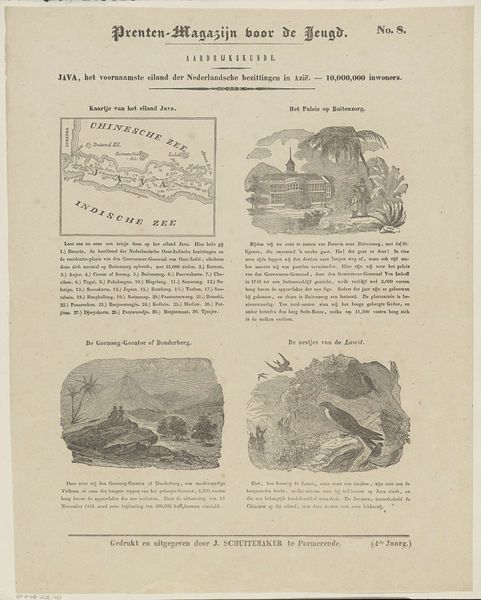
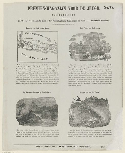
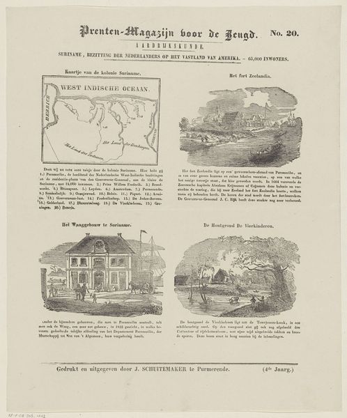
Java, het voornaamste eiland der Nederlandsche bezittingen in Azië. - 10,000,000 inwoners 1850 - 1881
0:00
0:00
graphic-art, print, photography, engraving
#
graphic-art
# print
#
landscape
#
photography
#
engraving
Dimensions: height 423 mm, width 301 mm
Copyright: Rijks Museum: Open Domain
This educational print was made in Leiden by D. Noothoven van Goor. It gives a Dutch perspective on the geography of Java, at a time when it was a major colonial possession. The printmaking process itself is important to consider. The crisp lines of the images – the map, the buildings, the landscape – are likely the result of etching or engraving. These are intaglio processes, where lines are incised into a metal plate, which is then inked and printed with great pressure. It’s a means of production well suited to mass communication. We should consider what it meant to represent a place like Java in this way, reducing it to manageable images and blocks of text. The act of printing flattens the reality of colonial exploitation into a reproducible commodity, intended to educate and persuade the Dutch public. The images here served to familiarize and normalize Dutch colonial power.
Comments
No comments
Be the first to comment and join the conversation on the ultimate creative platform.
More like this