print, engraving
#
dutch-golden-age
# print
#
old engraving style
#
landscape
#
geometric
#
engraving
Dimensions: height 465 mm, width 538 mm
Copyright: Rijks Museum: Open Domain
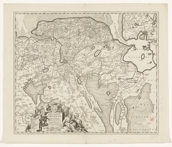
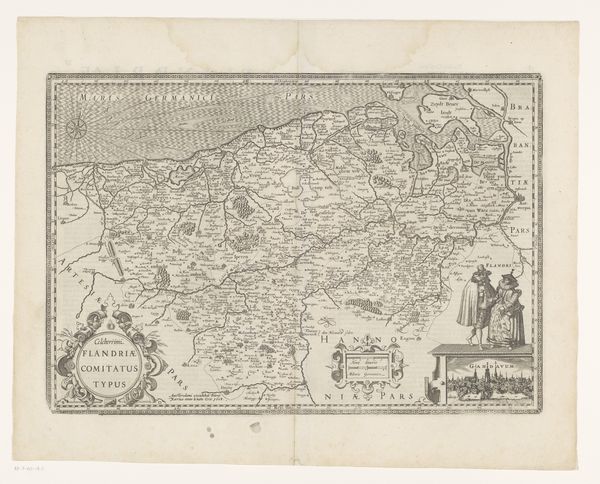
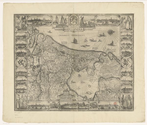
Curator: This engraving presents a cartographic rendering titled "Kaart van Overijssel," dating roughly from 1655 to 1706. Its creation, done by Anonymous, using the engraving medium, evokes a strong sense of early map-making. Editor: My initial thought? Look at this landscape captured so meticulously. All those tiny etched lines give it this incredible textural depth, like you could almost feel the lay of the land. Curator: Exactly, it speaks volumes about the skills involved in the printing and visual communications in that period, with emphasis to Overijssel during the Dutch Golden Age. The lines used, what can be seen here from water, or land are all so meticulously carved to reflect reality to the greatest degree. What statements may the anonymous individual be making about Overijssel at the time by carving this place? Editor: Thinking about its production, can you imagine the hours upon hours spent meticulously etching every tiny detail? Each line isn't just geographical data, it's a testament to labor. And what kind of skill set did that anonymous person have? Curator: Yes, the printing process indeed demanded an extremely meticulous level of skill. Given its era, it undoubtedly played a public role, conveying geographical knowledge and possibly serving political or strategic ends as well, showcasing an attempt for power via having cartographical knowledge. Editor: And consider who owned or interacted with this. This map may not have been accessible to everyone, considering literacy levels and access to print materials, which brings into question class and economic status. Curator: That's precisely where the interesting aspect is. This engraving served specific cultural functions, influencing understandings of space, identity, and even territorial claims. It played a pivotal role in how Overijssel was perceived both locally and abroad. Editor: Thinking of those precise details again, it reflects human influence. The rivers have names and roads are being carved out through it, therefore claiming this space for the people within it. It has been a compelling piece for sure, offering unique insights to cartography production. Curator: Indeed, by unveiling its intricate details, cultural context, and its historical narratives, we come to a greater and more nuanced appreciation for map-making in shaping perceptions during the Dutch Golden Age.
Comments
No comments
Be the first to comment and join the conversation on the ultimate creative platform.
More like this