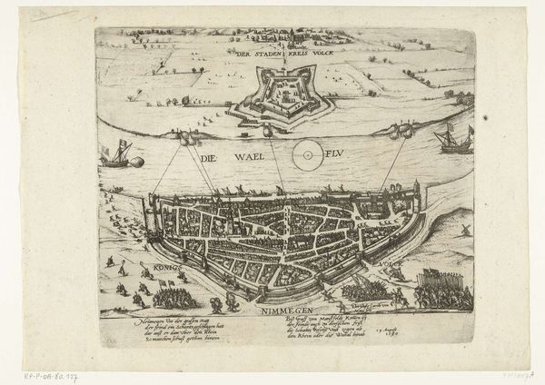
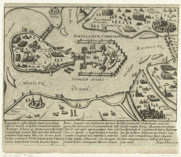
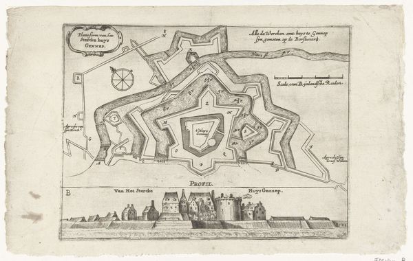
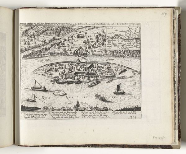
Plattegrond van Kampen, veroverd door de bisschop van Munster in 1672 1672
gasparbouttats
Rijksmuseum
drawing, graphic-art, print, etching, engraving
drawing
graphic-art
baroque
dutch-golden-age
etching
cityscape
engraving
Dimensions: height 197 mm, width 257 mm
Copyright: Rijks Museum: Open Domain
Curator: Here we have Gaspar Bouttats’s "Plattegrond van Kampen, veroverd door de bisschop van Munster in 1672," created in, unsurprisingly, 1672. It’s currently held in the Rijksmuseum collection. It is done using graphic art techniques: etching and engraving. Editor: Immediately striking is the incredible detail. It's a somewhat clinical depiction, yet somehow inviting. I find myself drawn to the miniature landscape nestled within the larger print, almost a scene within a scene. Curator: Right, it’s interesting how Bouttats uses that framed landscape view to complement the aerial perspective of the city plan. Consider the role these city plans played, not just as records, but as political tools, shaping how power was visualized and understood during a time of conflict. Editor: I’m thinking about the materials themselves. The act of etching and engraving demands meticulous skill and a certain type of labor. Were these prints widely circulated? What did it mean to possess such an image in the 17th century, in terms of access to information or status? Curator: These prints likely circulated among military officials and the wealthy elite. They served as a form of propaganda but also reflect growing demand in Dutch Golden Age for images of the self and surroundings. These were potent images during a period defined by religious and political clashes. It captures not just a city, but also a specific moment of conquest. Editor: And this moment frozen in ink emphasizes the temporary nature of control, as though imprinting Kampen’s capture into the historical record will make it lasting. What’s particularly telling, or rather, elusive, is the people. There’s bustling activity but no signs of individuals. This adds to the sterile, diagrammatic feeling. It is both a portrait and a record of possession. Curator: The print medium allowed for a standardized depiction of military control to proliferate beyond a select audience. Its graphic nature serves to objectify a location of military and social value by emphasizing form over function, especially if mass produced. Editor: I see, emphasizing its inherent commodification and consumption potential through reproducibility as the printing medium's primary asset for socio-economic mobility. These city plans can reveal layers about power, knowledge, and the intersection of art, craft, and the political climate. Curator: Yes. Analyzing the "Plattegrond van Kampen," we are reminded of art’s power in shaping perceptions of place and reinforcing historical narratives.
Comments
No comments
Be the first to comment and join the conversation on the ultimate creative platform.