drawing, watercolor
#
drawing
#
dutch-golden-age
#
landscape
#
watercolor
#
coloured pencil
#
cityscape
Dimensions: height 165 mm, width 284 mm, height 532 mm, width 318 mm
Copyright: Rijks Museum: Open Domain
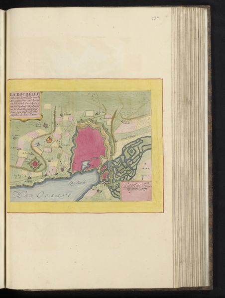
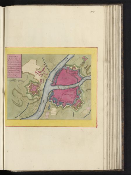
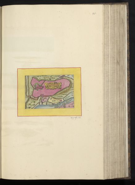
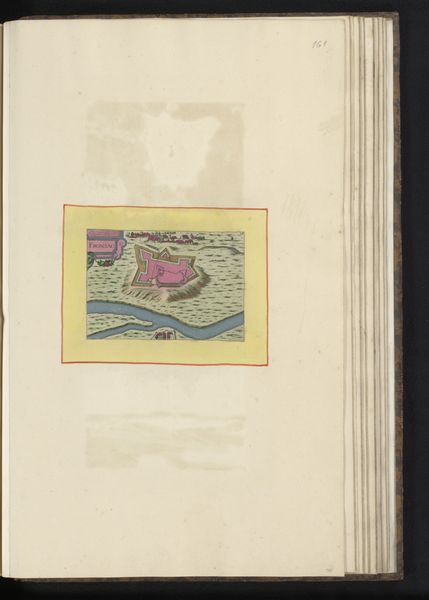
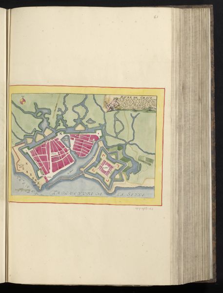
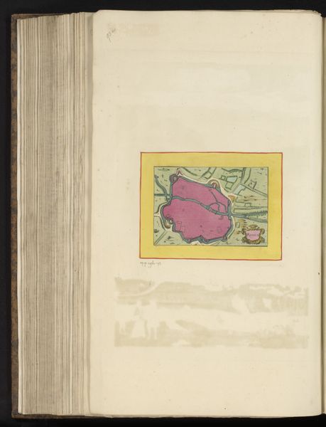
Curator: We are looking at a drawing entitled "Plattegrond van Granville" dating back to 1657, created by an anonymous artist. It is rendered with watercolor and what appears to be coloured pencil. What strikes you initially? Editor: The colors, definitely. The soft blues and ochres create a gentle, almost idyllic scene. It reminds me of a washed-out dream. Curator: The formal structure of the image supports that impression. The composition is rather clever, segmenting land and sea with blocks of colour contained neatly within a frame. How do you respond to its medium and historical style? Editor: Well, as a materialist, I see the choices in media as integral to understanding the work. The watercolor suggests transparency, perhaps implying a truth about the subject of this cityscape? The colours, chosen deliberately, could point us to environmental factors – availability of pigment, the dominance of a particular trading post for materials. What social or political functions might this image have served? Curator: Interesting point. Certainly, this rendering reflects Dutch Golden Age sensibilities. It's reminiscent of other landscape painting from the period, though I imagine it was not strictly created for its aesthetic pleasure. Perhaps this was used to aid with urban planning? Note the carefully illustrated dwellings tightly bound together for the purposes of defense. Editor: Right. The very act of mapping is an assertion of control and dominion over space. We also can consider who had access to materials such as paper, pigment, and binding? Understanding those limitations provides insights into who was creating art, and who could access and consume art in the mid-17th Century. Curator: That's a powerful reminder of the materiality shaping even representational work. I am especially drawn to the clean lines of the rendering. Perhaps what ultimately compels about this work, “Plattegrond van Granville," is the convergence of its formal construction, its material reality, and its cultural intentions. Editor: Indeed. Considering the artist's choices in conjunction with its societal position is vital to approaching an accurate understanding of art in historical and cultural settings.
Comments
No comments
Be the first to comment and join the conversation on the ultimate creative platform.
More like this