print, engraving
#
dutch-golden-age
# print
#
landscape
#
geometric
#
cityscape
#
engraving
#
realism
Dimensions: height 548 mm, width 651 mm
Copyright: Rijks Museum: Open Domain
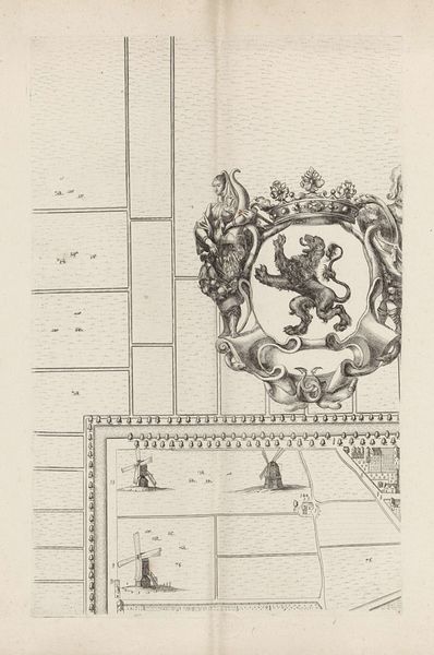
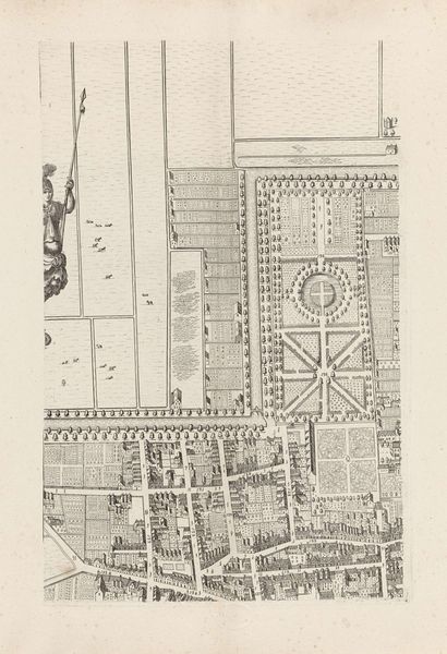
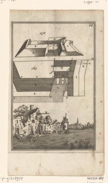
Cornelis Elandts created this print of The Hague in the late 17th century, using etching—a process in which acid bites into a metal plate to create an image. The controlled application of this corrosive liquid allows for incredibly fine lines. Here, the lines define not only the architecture of the city, but also tools of the surveyor’s trade. Scales, globes, and rolls of parchment are all meticulously rendered. The linear precision and detail of these objects demonstrates the mastery of the engraver, capable of illustrating scientific accuracy. Such prints served a practical function. This example shows how the technology of printmaking was deeply intertwined with the growth of commerce and the rise of cities in the Netherlands. The commercialization of images, and the division of labor that it implies, separates this kind of work from the traditional category of “fine art." This invites us to consider all forms of skilled making as culturally significant.
Comments
No comments
Be the first to comment and join the conversation on the ultimate creative platform.
More like this