#
amateur sketch
#
light pencil work
#
pencil sketch
#
hand drawn type
#
personal sketchbook
#
ink drawing experimentation
#
pen-ink sketch
#
sketchbook drawing
#
sketchbook art
#
initial sketch
Dimensions: height 299 mm, width 264 mm
Copyright: Rijks Museum: Open Domain
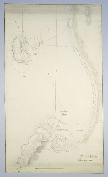
This plan of the old city of Manduria was made by Willem Carel Dierkens using ink and watercolor. These were the traditional tools of the surveyor in the 18th century, and the artist's hand is clear in the confident lines and washes. But it's worth noting what Dierkens isn't doing here. He wasn't simply recording an objective reality, but rather, making a set of visual claims. The walls and roads aren't just described; they're imbued with a certain character through the confident application of ink. The washes of watercolor add another layer, conveying a sense of depth and atmosphere. Even the choice of paper, with its subtle texture, contributes to the overall effect. In a sense, Dierkens was as much a craftsperson as a cartographer. By understanding the materials and techniques involved, we can appreciate how this image transcends mere documentation and becomes a work of art in its own right. It challenges our assumptions about the boundaries between craft, design, and fine art.
Comments
No comments
Be the first to comment and join the conversation on the ultimate creative platform.
More like this