print, engraving
#
narrative-art
# print
#
old engraving style
#
landscape
#
geometric
#
engraving
Dimensions: height 140 mm, width 220 mm
Copyright: Rijks Museum: Open Domain
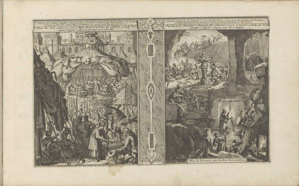
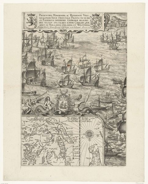
This map of the Cape of Good Hope and Table Bay was created anonymously in 1601 using engraving, a printmaking technique. The process begins with a metal plate, likely copper, into which the design is meticulously incised using a tool called a burin. The engraver's skilled labor is evident in the fine lines that delineate coastlines, mythical sea creatures, and the ornate cartouches bearing coats of arms. Note how the density and direction of these lines create tonal variations, simulating light and shadow. The map's aesthetic appeal, however, belies its primary function: to facilitate Dutch maritime trade with the East Indies. The map, therefore, becomes a potent symbol of early capitalism, connecting artistic skill with colonial ambition. The labor of the anonymous engraver, combined with the material properties of metal and ink, ultimately served the interests of commerce and empire. It’s a reminder that even the most delicate artwork can be deeply enmeshed in broader social and economic forces.
Comments
No comments
Be the first to comment and join the conversation on the ultimate creative platform.
More like this