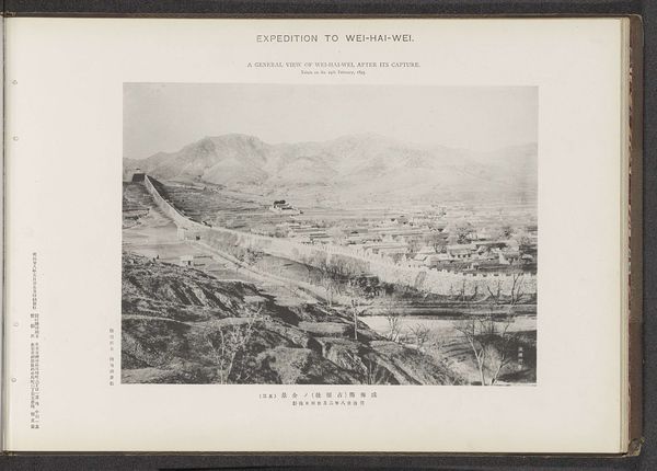
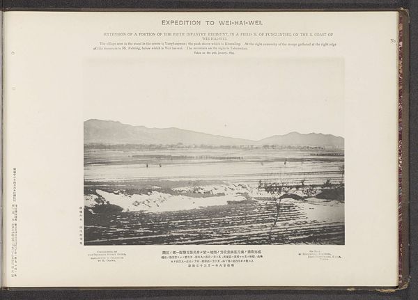
Muster of a greater portion of the second division on a hill south of Kopei, on the S. E. Coast of Wei-Hai-Wei, after its capture Possibly 1895
0:00
0:00
photography, gelatin-silver-print
#
landscape
#
photography
#
gelatin-silver-print
Dimensions: height 207 mm, width 284 mm
Copyright: Rijks Museum: Open Domain
This photograph of Wei-Hai-Wei on the southeast coast of China was taken by the Ordnance Survey Office in January 1895. It depicts the mustering of troops after the capture of the city. Wei-Hai-Wei was a strategic port, and its capture by Japan during the First Sino-Japanese War marked a significant moment in the decline of the Qing Dynasty and the rise of Japanese imperial power. The Ordnance Survey Office, a British institution, documents the Japanese military presence, reflecting Britain's own imperial interests in the region. The photo presents a specific view of this historical event that invites us to consider the politics of imagery. To understand the photograph, it's important to look into the historical context, researching the First Sino-Japanese War and the geopolitical interests of the various nations involved. Images like this provide a window into the past, but their meaning is always shaped by the social and institutional forces.
Comments
No comments
Be the first to comment and join the conversation on the ultimate creative platform.
More like this