1629
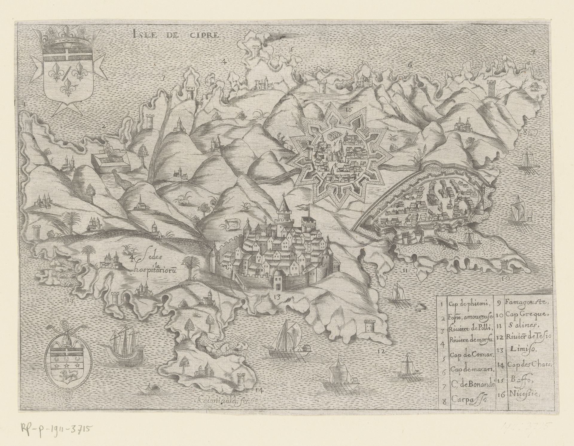
Kaart in vogelvlucht van het eiland Cyprus
Listen to curator's interpretation
Curatorial notes
This is Henry Raignauld’s bird's-eye view map of the island of Cyprus, rich with symbols that transcend mere geography. Note the heraldic crests adorning the upper-left and lower-left corners. These emblems aren't just decorative; they are declarations of power, echoing the authority of ruling families and institutions. Consider the walled cities rendered with striking detail. These fortifications are not merely defensive structures. They are visual embodiments of security, order, and control, reminiscent of citadels in ancient Near Eastern art, symbols of civilization against the perceived chaos of the outside world. The ships sailing the surrounding seas also speak volumes. They are vessels of commerce and conquest and also connect Cyprus to a broader world, their presence invoking the psychological interplay between the known and the unknown, the safe harbor and the perilous journey. This resonates deeply with humanity’s collective memory, the primal urge to explore and expand, yet also the fear of the uncharted. The map, therefore, is more than just a depiction of land; it's a tableau of power, security, and human ambition, continually reimagined through history.