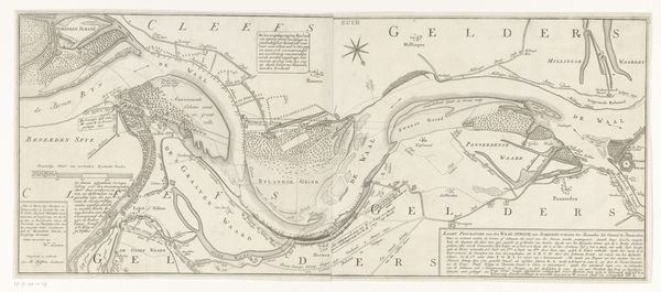
print, engraving
#
baroque
# print
#
old engraving style
#
geometric
#
line
#
cityscape
#
engraving
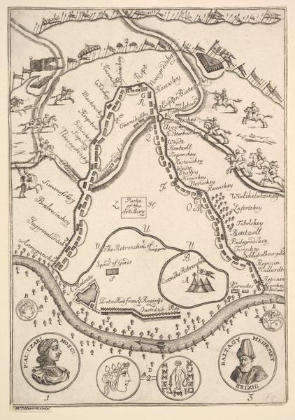
Dimensions: height 373 mm, width 264 mm
Copyright: Rijks Museum: Open Domain
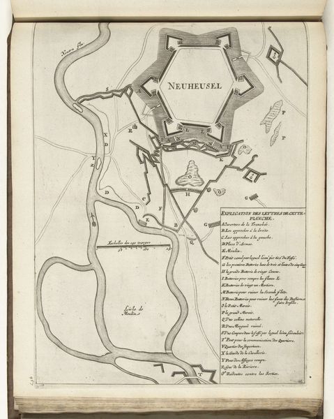
This is an anonymous map of Neuhäusel, dating to around 1702, made with ink on paper. The first thing to notice is the precision of the line work. This wasn't simply drawn; it was etched. The map would have begun with a prepared metal plate, likely copper, coated with a waxy ground. Using fine tools, the mapmaker would then carefully cut away the ground, exposing the metal beneath. The plate was then submerged in acid, which bit into the exposed lines, creating grooves. Ink was applied to the plate, forced into these grooves, and the surface wiped clean, allowing the image to be transferred onto paper under high pressure. Think of the labour involved; the careful drawing, the acid-biting process, the operation of the printing press. Cartography in this period was not just about geography, but also about power. The ability to accurately map territory was crucial for military and administrative control. This print, therefore, isn't just a picture, it's a potent symbol of early modern statecraft. It reminds us that even seemingly straightforward images are the product of complex social forces and skilled hands.
Comments
No comments
Be the first to comment and join the conversation on the ultimate creative platform.
More like this