Plattegrond van burgerwijk 30 in Amsterdam, onder leiding van kapitein Philippus Roos 1751 - 1795
0:00
0:00
reiniervinkeles
Rijksmuseum
drawing, print, ink
#
drawing
#
dutch-golden-age
#
mechanical pen drawing
# print
#
pen illustration
#
pen sketch
#
landscape
#
personal sketchbook
#
ink
#
sketchwork
#
ink drawing experimentation
#
geometric
#
pen-ink sketch
#
pen work
#
sketchbook drawing
#
cityscape
#
storyboard and sketchbook work
Dimensions: height 321 mm, width 470 mm
Copyright: Rijks Museum: Open Domain
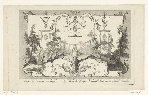
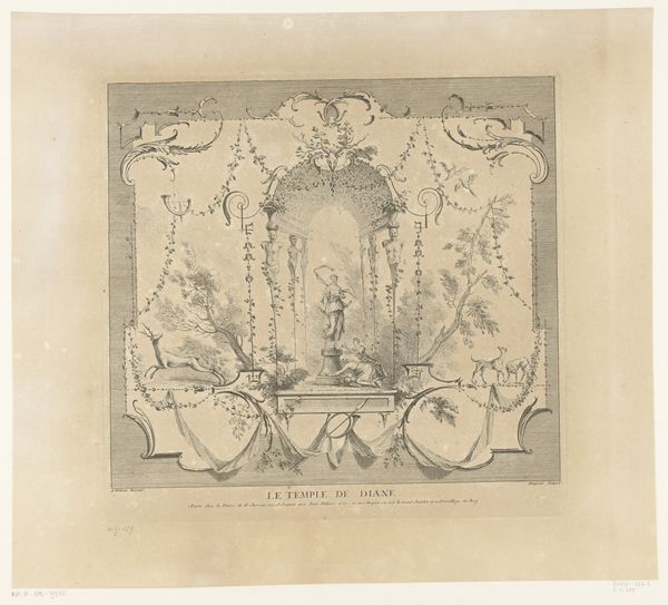
Curator: This is "Plattegrond van burgerwijk 30 in Amsterdam, onder leiding van kapitein Philippus Roos," or, "Map of ward 30 in Amsterdam under the leadership of Captain Philippus Roos." The print, attributed to Reinier Vinkeles, likely dates from between 1751 and 1795. Editor: My immediate impression is how meticulously detailed this map is. There's an almost obsessive quality to the rendering of each building and street. Curator: It is exceptionally detailed. The map shows a specific section of Amsterdam during a time of significant social and political change. Think about the Dutch Republic's evolving identity. Maps like these were vital for administration and control. Editor: And I'm intrigued by the choice of symbols. At the bottom, we have the arms and military equipment, alluding to Captain Roos's leadership role, and the boundaries outlined with crests indicating social ranks within. Is it emphasizing order and structure? Curator: Precisely. Maps not only charted geographical space but also asserted political authority. The display of weaponry and the suggestion of civil order served as a symbolic representation of power within Amsterdam’s urban landscape. Editor: Beyond the political statement, there is something almost playful about it. The decorative elements border the rigid structure of the city grid with organic scrolls and embellishments, which feels characteristic of that era. Curator: Good observation! These cartouches were fashionable at the time, providing a sense of prestige but also grounding it in contemporary taste and trends of artistic and commercial Dutch identity. Editor: I can't help but think of what is absent from the map. While buildings are marked and organized, people aren't visualized within the frame. I guess that this evokes how citizens were meant to interact in it. Curator: Yes, you're hitting on a critical aspect. The focus is on civic order, not individual lives. So this reflects broader ideals and functions. It suggests what this segment of Amsterdam wanted to convey and uphold for the present and the future. Editor: Thinking about how maps function today, with satellite imaging providing more information than ever, the detail-work like this, rendered with human care, offers a kind of human touch absent from today's data-driven images. Curator: Right, that personal touch reminds us of the role imagery and its cultural impact are very potent political markers in human experience. This makes it not merely a map, but an enduring piece of civic memory.
Comments
No comments
Be the first to comment and join the conversation on the ultimate creative platform.
More like this