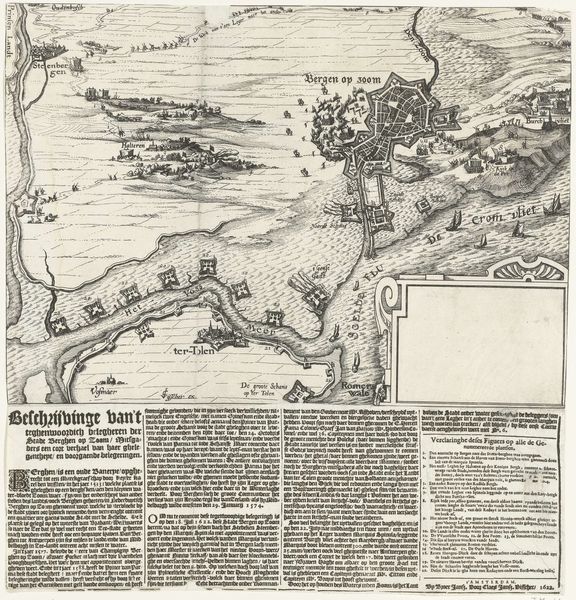
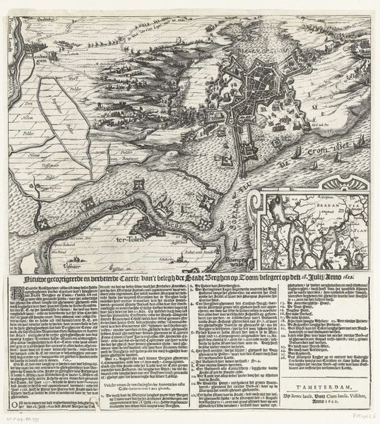
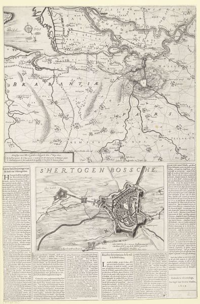
Kaart van Bergen op Zoom en Steenbergen met de nieuwe vestingwerken, 1628 1628
0:00
0:00
claesjanszvisscher
Rijksmuseum
graphic-art, print, etching, engraving
#
graphic-art
#
dutch-golden-age
# print
#
etching
#
landscape
#
engraving
Dimensions: height 372 mm, width 365 mm
Copyright: Rijks Museum: Open Domain
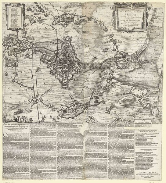
Claes Jansz. Visscher created this map of Bergen op Zoom and Steenbergen in 1628 with etching. Its stark monochrome palette and precise linework give a structured view of the fortified landscape. Notice how the geometric shapes define fields, waterways, and military fortifications. The map operates as a semiotic system, where each visual element functions as a sign. The lines represent boundaries, roads, and waterways; the shading and hatching indicate depth and texture; and the geometric shapes symbolize architectural and military structures. The arrangement of these elements communicates not only spatial relationships but also political and military power. Visscher’s precise rendering transforms the landscape into a coded document. Consider the map's overall structure: how it presents a controlled, rationalized view of space, reflecting a desire to impose order on the landscape. This impulse is not merely aesthetic; it speaks to broader cultural and philosophical concerns about knowledge, control, and representation during the early modern period.
Comments
No comments
Be the first to comment and join the conversation on the ultimate creative platform.
More like this