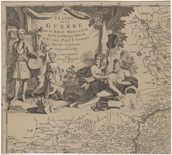
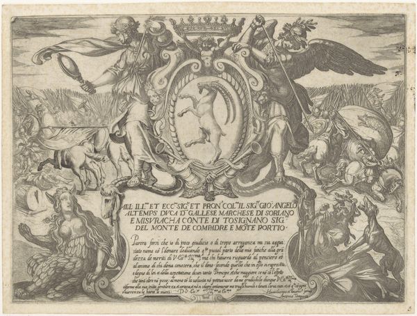
Kaart van de regio Solms tussen Marburg en Frankfurt am Main in Duitsland (blad rechtsboven) 1689 - 1712
print, engraving
baroque
mechanical pen drawing
pen illustration
pen sketch
figuration
line
history-painting
engraving
Dimensions: height 232 mm, width 255 mm
Copyright: Rijks Museum: Open Domain
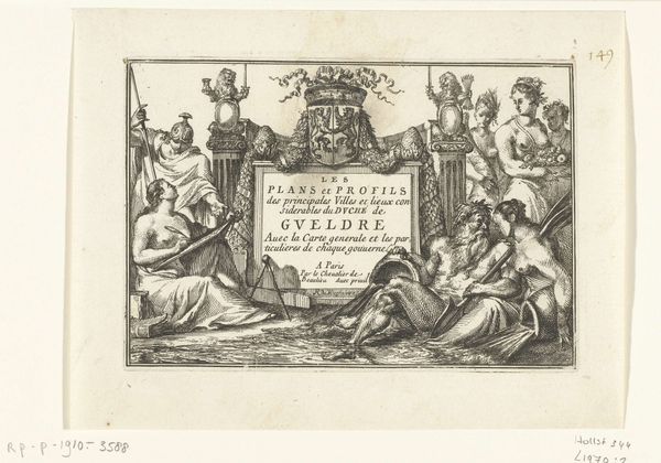
Editor: This engraving, dating from somewhere between 1689 and 1712, is called "Kaart van de regio Solms tussen Marburg en Frankfurt am Main in Duitsland (blad rechtsboven)" and it was created by Cornelis Huyberts. It feels almost theatrical, doesn’t it? A real stage for conflict. What story do you think it's trying to tell? Curator: It is theatrical! For me, the image explodes with paradox. It depicts the cold, calculated nature of cartography – yet it’s overflowing with allegory, figures from classical antiquity, war, cherubs… all rendered with incredibly fine lines. A very Baroque juxtaposition, don’t you think, of order and chaos? Do you notice how the artist weaves together devastation with an almost ornamental beauty? Editor: I do now! It’s a map, but it's also trying to make a statement about war… almost like a political cartoon? Curator: Exactly! This map is more than just geographical data; it's a commentary on the “theatre of war,” a term boldly emblazoned across the page. The burning villages, the stoic soldier… each element points to the devastating consequences of conflict, all framed within this incredibly ornate design. Are those angels playing with weapons above the title? I find that darkly funny! Editor: Yes! This has completely shifted my perspective. I was initially drawn to the drama, but I didn't appreciate how much commentary was embedded within the design itself. Curator: It’s like a beautiful, terrible dream, isn't it?
Comments
No comments
Be the first to comment and join the conversation on the ultimate creative platform.