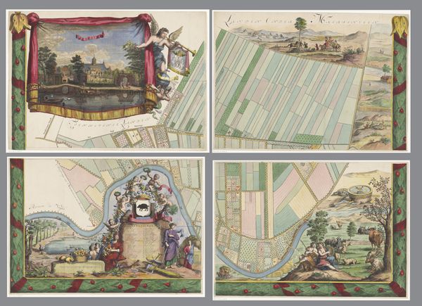
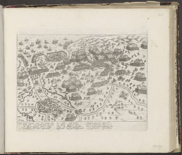
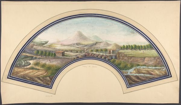
Plattegrond van de heerlijkheid Maarsseveen (deel rechtsboven) 1690 - 1691
0:00
0:00
philibertbouttats
Rijksmuseum
drawing, print, paper, watercolor
#
drawing
#
dutch-golden-age
# print
#
landscape
#
paper
#
watercolor
#
coloured pencil
#
watercolor
Dimensions: height 461 mm, width 650 mm
Copyright: Rijks Museum: Open Domain
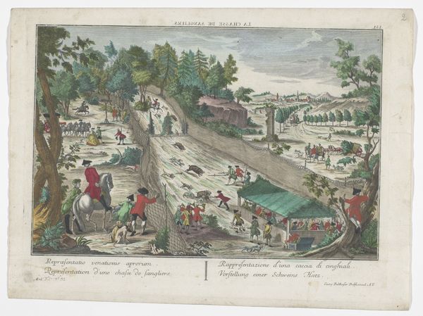
Philibert Bouttats created this section of a map of Maarsseveen with pen and watercolour in the 17th century. Land ownership in the Dutch Republic was a status symbol, so landowners often commissioned maps of their property. This example shows fields, forests, and houses, giving us some sense of the local economy and landscape. The map also offers a glimpse into the cultural life of the Dutch elite. In the upper part of the map, we can see a hunting scene, which was a popular pastime for the wealthy. These hunts were highly ritualized social events, reinforcing class boundaries. This map visualizes the economic and social order of the time. Maps like this one were important legal documents, used to settle property disputes and determine tax obligations. Researchers can consult archives, estate records, and legal documents to further explore the social and economic context of this artwork. Through such investigations, we see how art is always embedded in social and institutional practices.
Comments
No comments
Be the first to comment and join the conversation on the ultimate creative platform.
More like this