print, engraving
#
baroque
#
dutch-golden-age
# print
#
cityscape
#
engraving
#
watercolor
Dimensions: height 184 mm, width 220 mm
Copyright: Rijks Museum: Open Domain
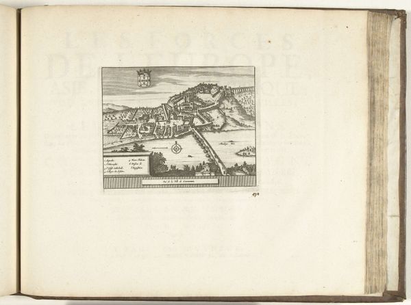
Here is the map of Venice made by Abraham Allard around the turn of the 18th century, with an engraving. Maps like these were not just geographical tools, they were also powerful statements about the city’s identity. Venice, during this time, was a major maritime power and a vital trade hub, and this map reflects that. Notice the ships filling the harbor, the detailed depiction of the city’s architecture, and the mask on the upper left corner, all visual signs of the wealth, sophistication, and unique cultural identity of Venice. The map presents Venice as a well-organized and prosperous city-state, an image carefully crafted for both internal consumption and external promotion. This was a time when European cities were competing for influence and prestige, and maps played a crucial role in shaping perceptions. Understanding this artwork requires us to look into the history of cartography, Venetian social history, and the political context of the early 1700s. By studying these aspects, we can appreciate the complex meanings embedded in this seemingly straightforward map.
Comments
No comments
Be the first to comment and join the conversation on the ultimate creative platform.
More like this