print, engraving
#
medieval
# print
#
cityscape
#
history-painting
#
engraving
Dimensions: height 448 mm, width 642 mm
Copyright: Rijks Museum: Open Domain
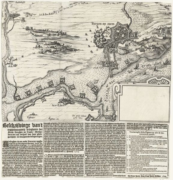
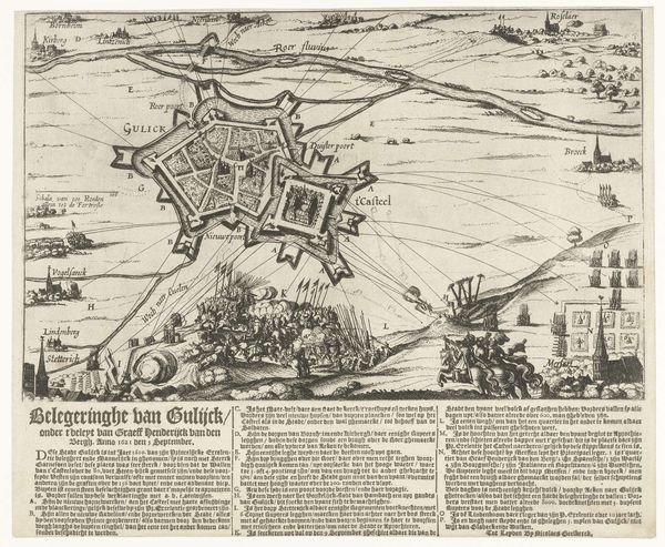
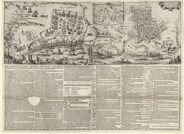
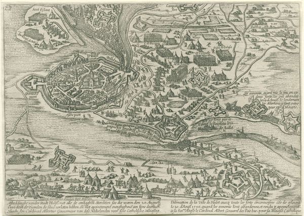
This anonymous print from 1610 depicts the Siege of Jülich in the Netherlands. It’s not just a pretty picture of a military engagement; it's a window into the political and social dynamics of the time. Printed maps like this weren’t just about showing geography; they were tools of power. The detailed depiction of fortifications, troop movements, and the surrounding landscape served to inform and impress. Consider the cultural context of the early 17th century, a time of intense religious and political conflict in Europe. The Dutch Republic was fighting for its independence from Spain, and control over territories like Jülich was strategically crucial. The level of detail suggests this print wasn’t meant for the average person. Its intended audience was likely military leaders, political elites, or wealthy merchants who had an interest in the outcome of these conflicts. As historians, we dig into archives, scrutinize maps, and analyze texts to understand the layers of meaning embedded in such images. The history of cartography, military history, and Dutch social history are all key to understanding this print.
Comments
No comments
Be the first to comment and join the conversation on the ultimate creative platform.
More like this