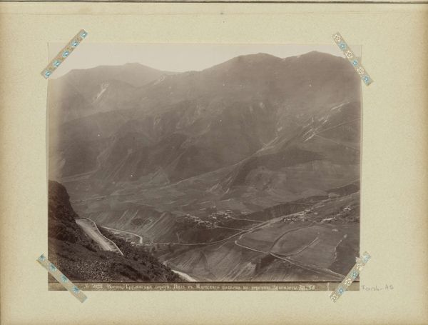
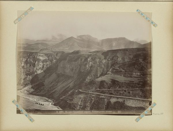
Berglandschap bij de militaire weg in Georgië c. 1890 - 1900
0:00
0:00
dimitriivanovitchermakov
Rijksmuseum
Dimensions: height 205 mm, width 265 mm
Copyright: Rijks Museum: Open Domain
Dimitri Ivanovitch Ermakov captured this photograph of a mountain landscape near the Georgian Military Road sometime in the late 19th or early 20th century. It presents a seemingly objective view of the Caucasus Mountains. Yet, consider the context: this road was a critical artery for the Russian Empire, enabling military control over the Caucasus. Ermakov, employed by the Russian army, wasn’t just documenting scenery. His photographs served a political purpose, mapping and documenting the landscape for imperial administration. The very act of photographing and naming these sites was a form of asserting dominance. We might think about institutions such as the military and the Russian Geographical Society and the demand they placed on photography. To fully understand this image, we need to explore archives, maps, and historical records. Only then can we grasp the complex interplay between art, power, and the construction of national identity in this contested region.
Comments
No comments
Be the first to comment and join the conversation on the ultimate creative platform.
More like this