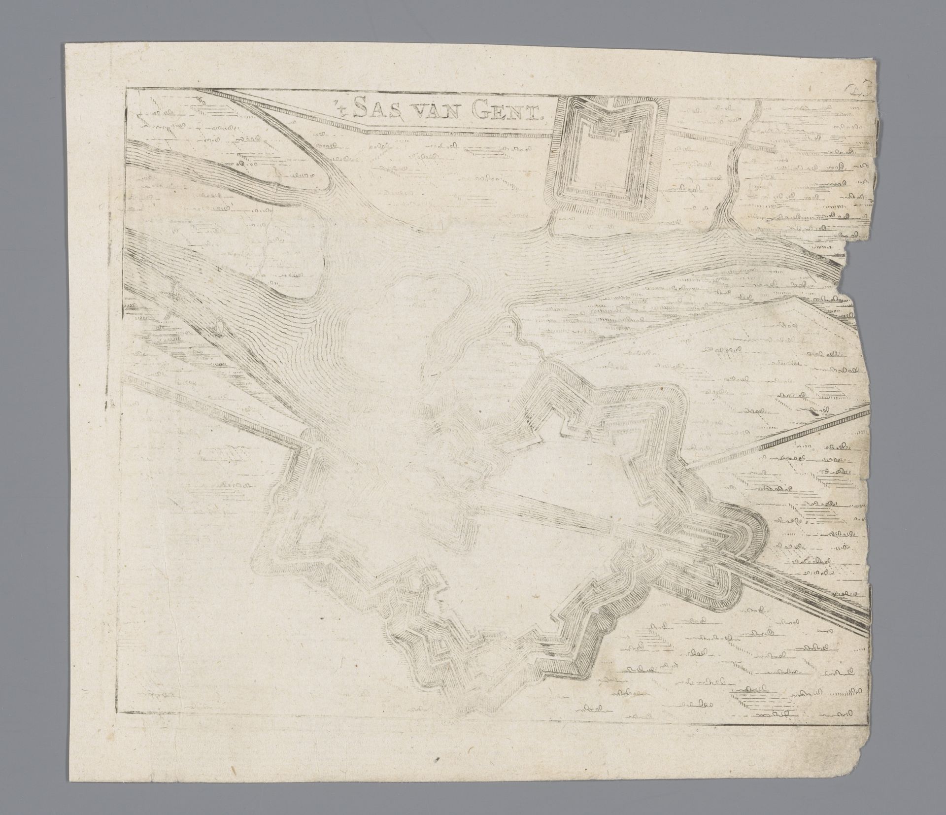
1660
Vestingplattegrond van Sas van Gent
Anonymous
@anonymousLocation
RijksmuseumListen to curator's interpretation
Curatorial notes
Curator: At first glance, I'm drawn to the stark geometry, this interplay of angular fortifications against a soft, seemingly hand-drawn landscape. It evokes a sense of strategic intent overlaid on the natural world. Editor: Indeed. What we’re observing is an anonymous print, titled “Vestingplattegrond van Sas van Gent,” dating back to 1660. It’s currently held in the Rijksmuseum collection, a fantastic resource for understanding the period. This drawing/print exemplifies cartography of the era, but it's also an object born of labor. Curator: The linework is fascinating, isn't it? Such meticulous detail. The contrast feels almost… brittle, capturing tension. The very visible signs of degradation on the paper underscore its history. Editor: Precisely! We must remember the paper-making process itself and what would be used to produce paper en masse during the seventeenth century. As an engraving, consider the skilled artisan transferring the intentions of the surveyors into reproducible images—making the military information accessible. The lines aren’t just lines; they are a product of work mediated through technologies. Curator: And the perspective! Note how the focus seems to shift depending where one looks, not unlike the sensation of observing from an elevated point. This impacts the visual harmony. Editor: Think about who consumed these maps and the political function they performed. Maps were a commodity! The accessibility speaks to the expansion of print culture and new forms of information consumption associated with a more complex bureaucratic and economic landscape in the 17th Century. Curator: Considering that it is an anonymous work, it does raise interesting questions about the intention. Without a known artist to assign creative expression to, does the focus simply move towards the depiction and message it aims to convey? Editor: Perhaps the anonymity itself points towards the distributed nature of this knowledge. Mapping was a social practice! Individual authorship wasn't emphasized—it was about reliable representation to serve military and political agendas of those who commissioned and consumed it. Curator: It adds a new layer to understanding how this piece uses compositional elements. Editor: Exactly, now consider who paid for the engraving and paper... Curator: It’s been so insightful viewing this city map. Thank you. Editor: It shows how much historical and social narratives reside in one image.