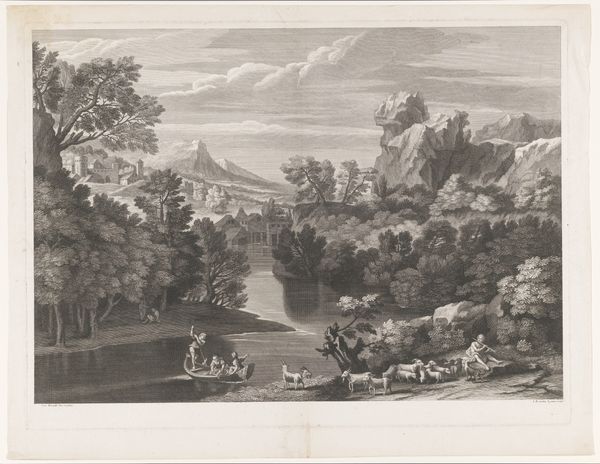
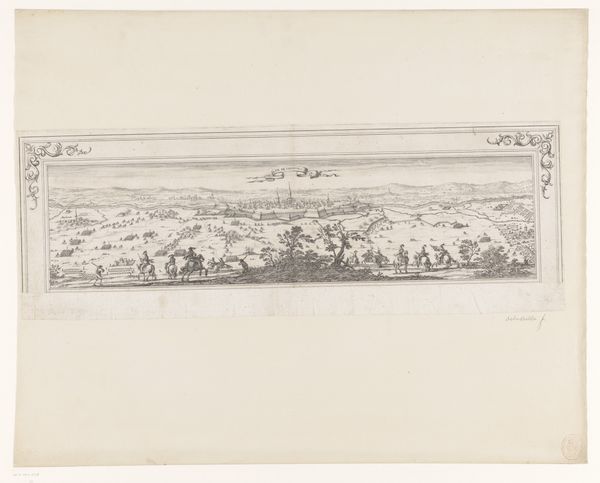
Plattegrond van de heerlijkheid Maarsseveen (deel rechtsonder) 1690 - 1691
philibertbouttats
Rijksmuseum
drawing, painting, watercolor, ink
drawing
baroque
painting
landscape
watercolor
ink
coloured pencil
watercolour illustration
genre-painting
Dimensions: height 454 mm, width 645 mm
Copyright: Rijks Museum: Open Domain
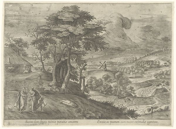
Philibert Bouttats created this section of a map of Maarsseveen, a municipality north of Utrecht, during the Dutch Golden Age. These detailed maps were more than geographical tools; they were declarations of power and property, reflecting the intense competition for land and resources in the burgeoning Dutch Republic. Notice how the pastoral scene, complete with grazing animals and leisure figures, contrasts sharply with the ordered grid of land plots. This juxtaposition highlights a tension between an idealized rural life and the realities of land management and ownership that often excluded the rural poor. The idyllic imagery suggests a harmonious relationship with nature, yet it obscures the labor and social hierarchies that shaped the landscape. This map invites us to reflect on how representations of land can both reveal and conceal the complex histories of social relations and power dynamics embedded within them. It encourages us to consider whose stories are told and whose are left out of these carefully constructed portrayals of place.
Comments
No comments
Be the first to comment and join the conversation on the ultimate creative platform.