About this artwork
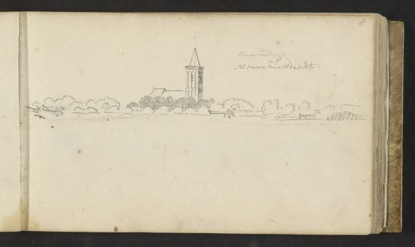
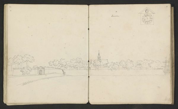
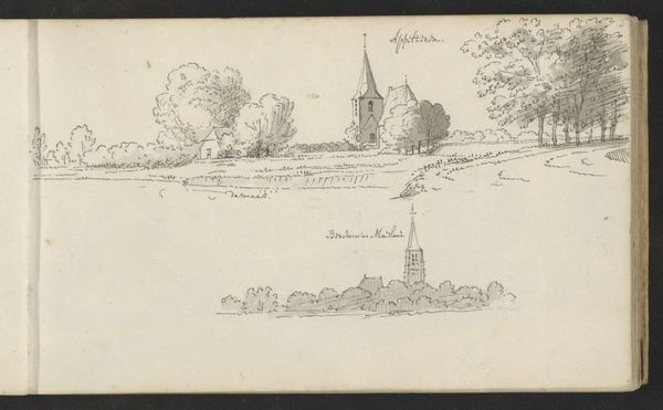
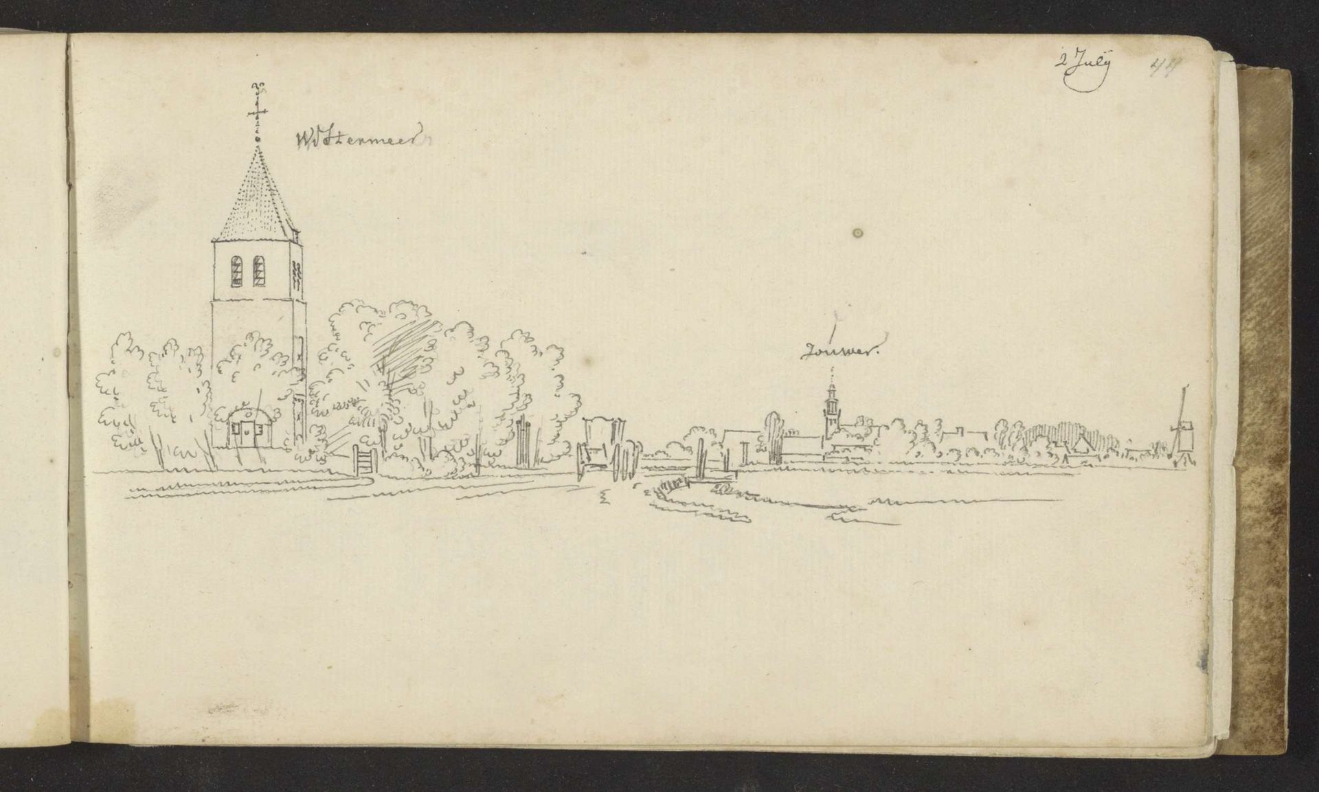
This drawing by Abraham de Haen the Younger captures the villages of Westermeer and Joure with delicate lines of ink on paper. The composition divides the landscape into distinct zones, inviting a comparative reading of the two locations. Notice how the taller church of Westermeer on the left commands immediate attention through verticality and precise detail. To the right, Joure presents a lower, more spread-out profile. The lines used to define Joure’s buildings and trees are looser, contributing to a sense of distance and perhaps a less defined community. The eye is drawn along the connecting road, suggesting a narrative of travel and linkage between the two places. De Haen’s subtle variations in line quality reveal a studied approach to representing space and the distinct character of each village. The drawing functions not merely as a record but as an interpretation of social and spatial relationships within the landscape.
Gezicht op Westermeer en Joure
Possibly 1732 - 1737
Abraham de (II) Haen
1707 - 1748Location
RijksmuseumArtwork details
- Location
- Rijksmuseum
- Copyright
- Rijks Museum: Open Domain
Tags
Comments
Share your thoughts
About this artwork
This drawing by Abraham de Haen the Younger captures the villages of Westermeer and Joure with delicate lines of ink on paper. The composition divides the landscape into distinct zones, inviting a comparative reading of the two locations. Notice how the taller church of Westermeer on the left commands immediate attention through verticality and precise detail. To the right, Joure presents a lower, more spread-out profile. The lines used to define Joure’s buildings and trees are looser, contributing to a sense of distance and perhaps a less defined community. The eye is drawn along the connecting road, suggesting a narrative of travel and linkage between the two places. De Haen’s subtle variations in line quality reveal a studied approach to representing space and the distinct character of each village. The drawing functions not merely as a record but as an interpretation of social and spatial relationships within the landscape.
Comments
Share your thoughts