drawing, paper, ink, architecture
#
drawing
#
baroque
#
landscape
#
paper
#
ink
#
geometric
#
cityscape
#
architecture
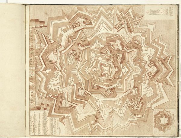
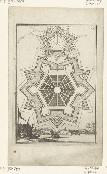
Dimensions: height 528 mm, width 735 mm
Copyright: Rijks Museum: Open Domain
This ‘Plattegrond van Coevorden’ was made circa 1701-1715 by Samuel Du Ry de Champdoré, using pen and grey and pink ink on paper. The drawing shows the fortifications surrounding the city of Coevorden, with careful use of shading to lend a three-dimensional feel to the ramparts. It is an exquisite example of draftsmanship, demonstrating the essential role of drawing in military engineering during the early 18th century. Look closely, and you’ll see the precise application of ink, building up tone and texture. The city itself is rendered in pink ink, while the fortifications are in grey ink, suggesting an integration of art and utility. The artist would have required not only artistic skill, but also a deep understanding of military architecture and defensive strategies. Ultimately, this drawing blurs the boundaries between art, craft, and technical drawing. It reminds us that the creation of an image could be a potent form of knowledge.
Comments
No comments
Be the first to comment and join the conversation on the ultimate creative platform.
More like this