print, engraving, architecture
#
baroque
# print
#
old engraving style
#
cityscape
#
engraving
#
architecture
Dimensions: height 519 mm, width 411 mm
Copyright: Rijks Museum: Open Domain
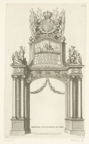
This is the lower right section of an undated map of Brussels, created by an anonymous artist. In this period, maps were not just geographical tools, but complex statements about power, identity and place within a rapidly changing world. The map is dedicated to Philip IV, King of Spain, and Holy Roman Emperor. Brussels, at the time, was part of the Spanish Netherlands, placing it at the heart of European political and religious conflicts. The elaborate cartouche, flanked by allegorical figures and crowned with the Spanish coat of arms, isn't just decorative. It’s a bold assertion of Spanish authority in a region rife with cultural and political tensions. Consider this map not just as a representation of space, but also as an artifact steeped in the narratives of colonial power. The map invites us to consider the lives of those who navigated, lived and resisted within the lines drawn by empires.
Comments
No comments
Be the first to comment and join the conversation on the ultimate creative platform.
More like this