drawing, engraving, architecture
#
architectural sketch
#
drawing
#
baroque
#
perspective
#
line
#
cityscape
#
engraving
#
architecture
Dimensions: height 150 mm, width 86 mm
Copyright: Rijks Museum: Open Domain
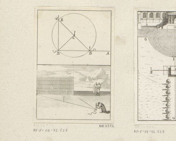
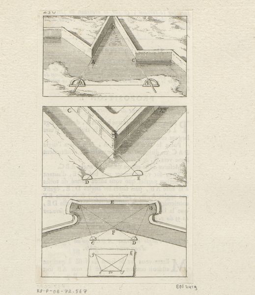
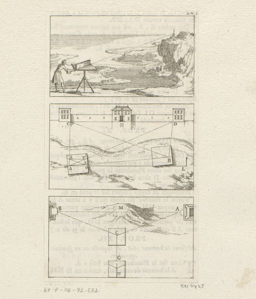
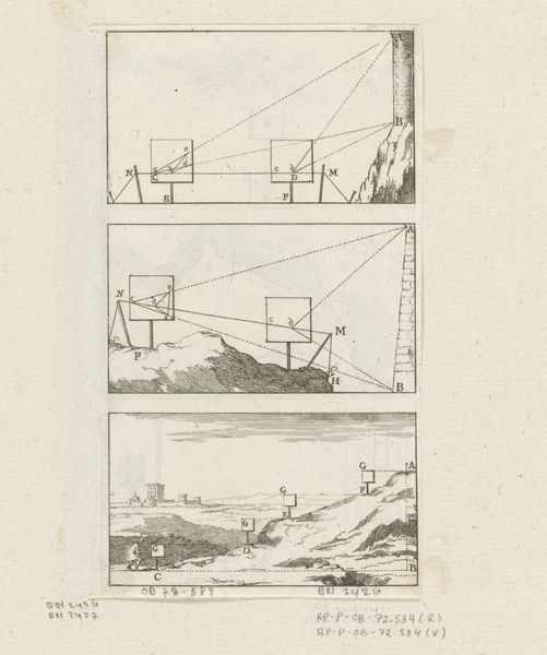
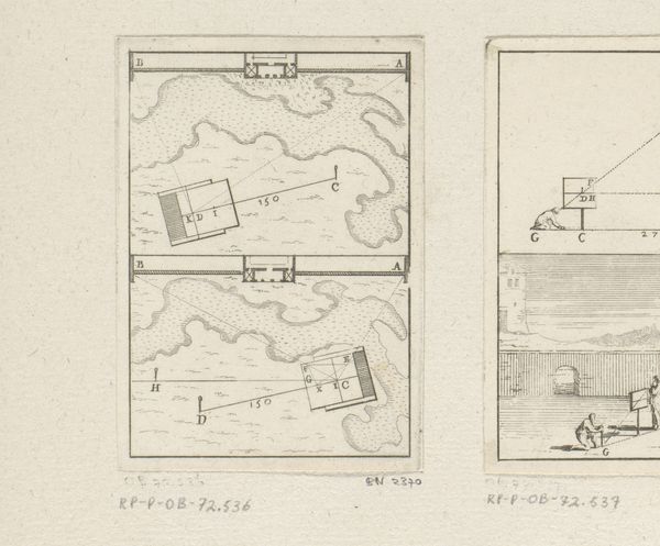
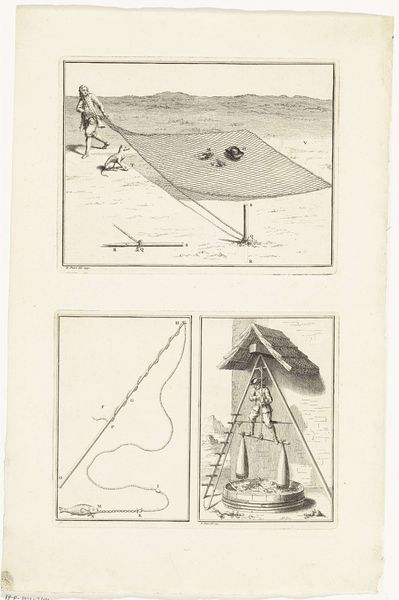
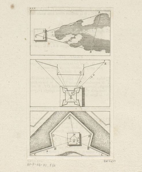
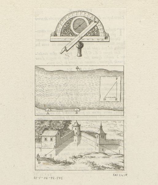
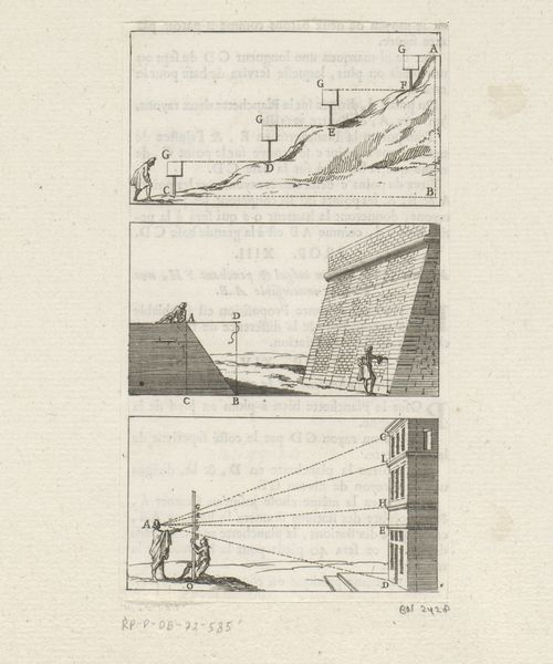
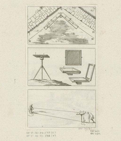
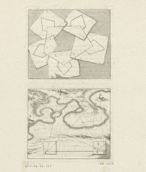
Sébastien Leclerc I created this print called 'Use of a Plane Table Illustrated' in the 17th century, using etching. This French print demonstrates the use of a plane table, an instrument used for surveying and creating accurate maps. During this period, cartography was essential not only for exploration and trade but also for military strategy and territorial control. The institutional context of map-making was often linked to state power, with governments commissioning surveys to better administer their territories. The image shows a series of diagrams illustrating how the plane table could be used to measure distances and angles, allowing for the creation of detailed and precise plans of landscapes and fortifications. In its own way, it comments on the social structures of its time, highlighting the importance of scientific accuracy and technological innovation in serving the interests of the state. To understand this work better, it would be useful to research the history of cartography, military engineering, and the role of the French state in promoting scientific advancements during the 17th century.
Comments
No comments
Be the first to comment and join the conversation on the ultimate creative platform.
More like this