drawing, print, watercolor
#
drawing
#
baroque
# print
#
landscape
#
watercolor
#
coloured pencil
#
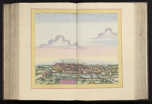
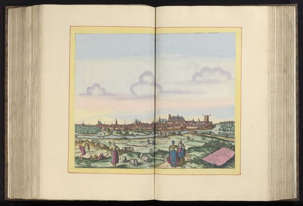
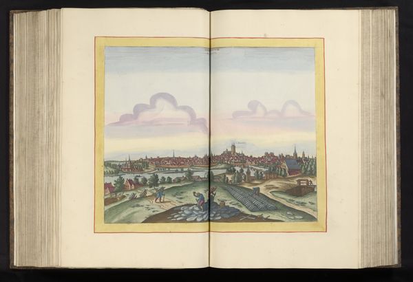
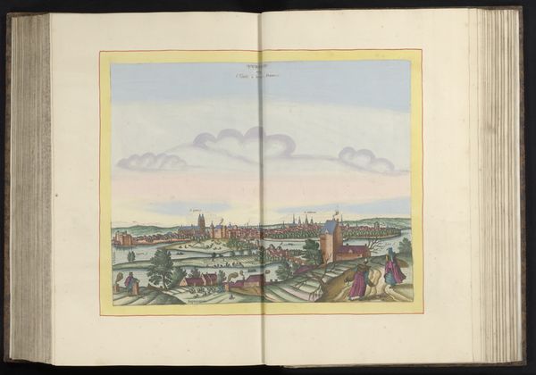
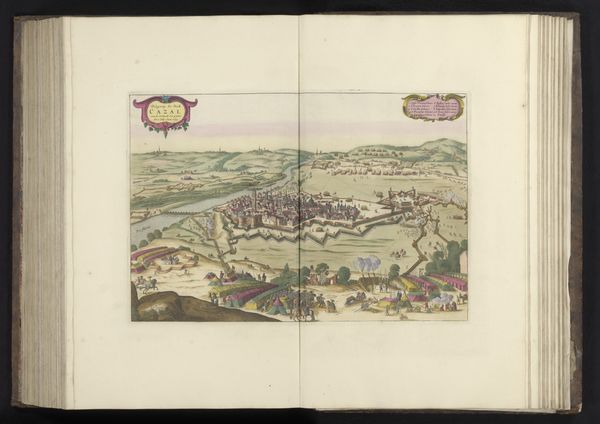
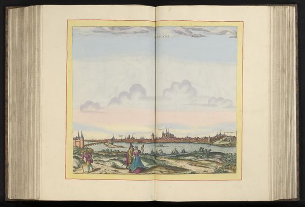
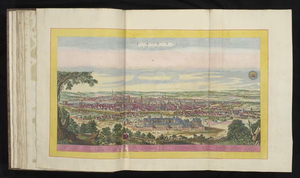
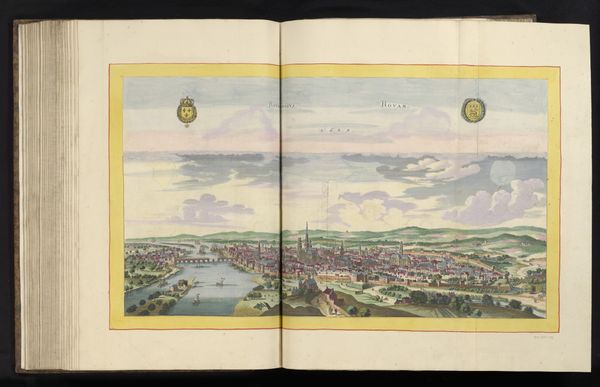
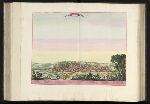
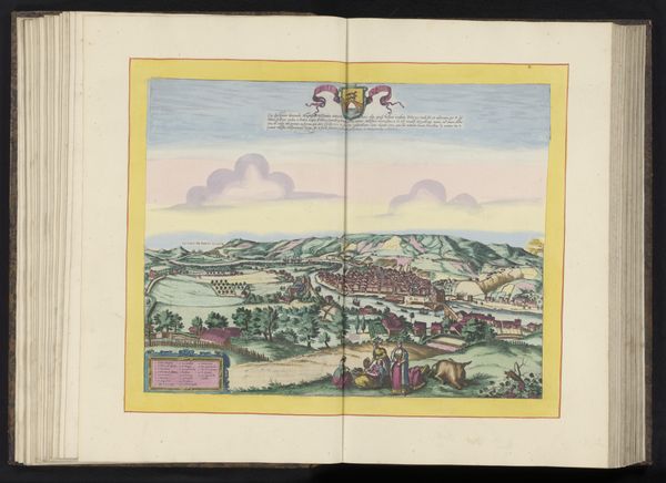
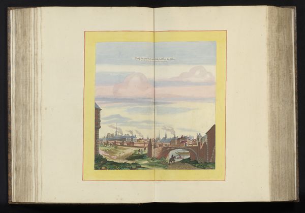
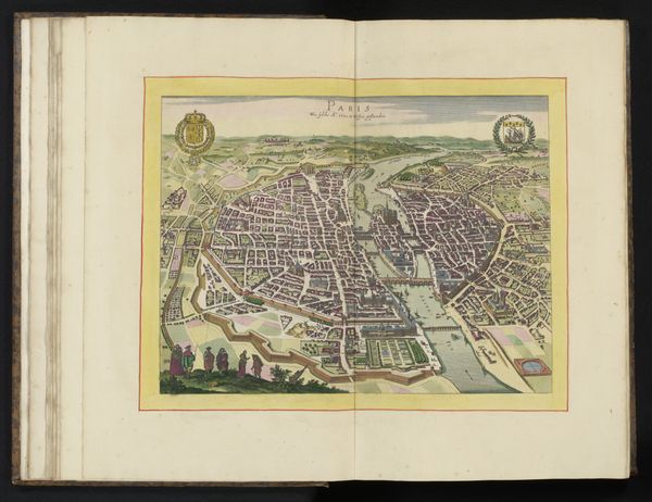
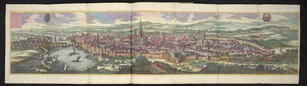
cityscape
Dimensions: height 364 mm, width 489 mm, height 532 mm, width 636 mm
Copyright: Rijks Museum: Open Domain
Editor: This captivating "Bird's-Eye View of Poitiers" from sometime between 1596 and 1682 is a watercolor drawing or print held at the Rijksmuseum. It's hard to tell! It feels so idyllic, and the pastel shades give the city a kind of dreamlike quality. What do you see in this piece that stands out? Curator: The city portrait, even in rendering, carries echoes of its strategic and cultural importance. What catches my eye is how the image makers were wrestling with power and perspective. They attempt this ‘god’s eye’ view to survey their domain. This distance creates a tension. Do you see the fortified lines of the city? Editor: I do, now that you mention it. It's like this peaceful scene has a hidden military aspect to it. Curator: Exactly. The symbolism of a city portrait has to carry the memory of both its aspirations for heavenly connection, its place in the cosmos if you will, alongside its earthly protections. The church spires point upward, don't they? Consider those soft clouds hovering; are they divinely watching? Editor: It’s interesting how much is communicated through something that initially appears simply pretty! I was just focusing on the aesthetic qualities before. Curator: Precisely. The soft colours and pastoral details could even hint at aspirations for peace, presenting an idealised vision intended for civic pride or perhaps political messaging. What details resonate most with you now, after considering this duality? Editor: I think it’s the figures in the foreground. They seem so small and insignificant compared to the imposing city behind them. It puts the entire image into perspective! Thank you. Curator: And it’s through those contrasting scales that this image continues to resonate and provoke thought.
Comments
No comments
Be the first to comment and join the conversation on the ultimate creative platform.
More like this